The Rugged Charm of the Top of the Land of a Million Elephants
LUANG NAMTHA, Laos — The rugged, mountainous terrain of northern Laos is beautiful. While well off the beaten track and not really on the road to anywhere else, Luang Namtha and Oudomxai provinces are well worth seeing.
It’s bumpy, windy, and dusty. And since the road, known only as road number 13, is in much need of repair in many places and makes for such slow-going, you’ll have plenty of time to admire the view.
And what a view it is. The rugged, mountainous terrain of northern Laos is beautiful. Route 13 is one of the very few roads that pass through Luang Namtha and Oudomxai provinces in northern Laos. And if there are few roads, there are even fewer trains — actually, there are none at all in Laos — so by road is really your only option for getting around. The single-lane road winds its way along the tops of mountains and along ridges. In many places, it’s best not to look down if you’re nervous about heights, especially since this is not a place where the market for safety barriers is making anyone rich. Some of the road is paved, some isn’t — an annual casualty of the rainy season. So for many miles, you’ll be bumping your way along what amounts to a dirt track.
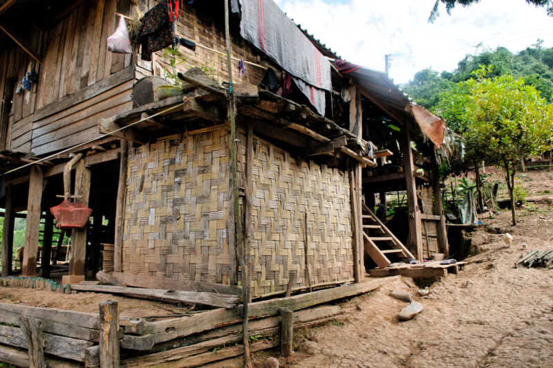
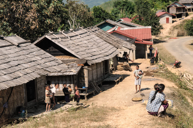
Every few miles, a village straddles the road. The traditional wood and bamboo houses of the Hmong and Kmu sit only a few feet from the road, the Kmu houses on stilts, and those of the Hmong low to the ground. And as the Lao government continues its efforts to relocate people from remote villages high in the mountains to new, ethnically integrated villages along the road, where they can more easily have access to basic utilities like electricity and running water, these roadside villages are getting more numerous. But as you pass the steep mountain peaks, you’ll also see in the distance many of the small, wooden huts used by farmers for tending and harvesting their mountain rice fields, often perched on impossibly steep mountainsides approachable only by foot. Integration and consolidation might be the government’s watchwords of the day, but modernization is still taken in baby steps.
Luang Namtha and Oudomxai provinces are solidly rural. Nevertheless, as remote from the bigger town as some of these villages are, several are quite prosperous thanks to money coming in from their massive northern neighbor: China. A particular specialty, well-suited to the lush terrain, is the growing of rubber trees, and thanks to the voracious appetite of China’s humming industrializing economy for rubber, many of the local villages in this part of northern Laos have become rich, at least by Lao standards.
So lucrative is the oozy crop that the provincial government has evidently decided to turn a blind eye to the creep of farming into the Nam Ha National Bio-Diversity Conservation Area, supposedly an ecologically protected zone. Hillsides have been cleared and rubber plantations encroach well inside the zone’s borders.
It becomes easy, after hours mount up traveling along road number 13, to take this combination of beautiful mountain scenery and small, traditional villages for granted. But it’s a striking contrast to the flat terrain of the town of Luang Namtha. Transliterated as “greater area of the River Nam,” translated as “”Royal Sugar Palm” or “Royal Green River,” and pronounced as “lwung namta” (the “h” of “th” is always silent), the town is a regional hub and a provincial capital — there’s even an airport, albeit not a big one. A shiny, new provincial museum building does double duty as a conference and meeting center. But despite some efforts by a few hotels in town to promote eco and adventure tourism, it is still off the usual beaten track for tourists.
Have Camera Will Travel // Newsletter
Practical field notes, hands-on gear tests.
Which is a shame, because that view along road number 13 is quite something.
NORTHERN LAOS, Laos — A row of woven bamboo rice storage huts lines a dirt road overlooking the region’s mountainous terrain. Elevating the granaries on wooden stilts provides essential ventilation while protecting the harvested crop from ground moisture and foraging rodents. Clustering these structures along the road, away from the main village dwellings, is a traditional safeguard designed to preserve the community’s vital food supply in the event of a house fire. Photo by David Coleman / Have Camera Will Travel
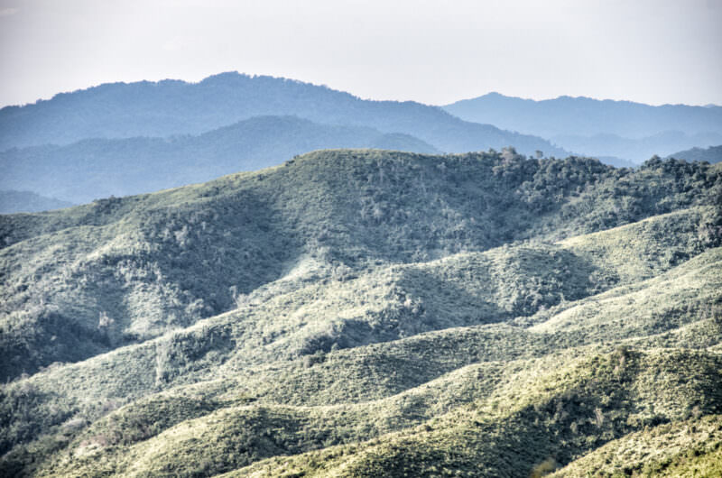
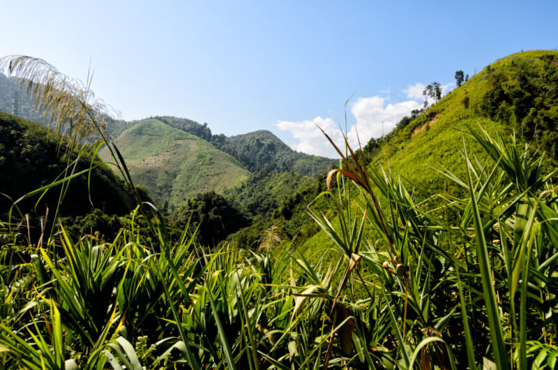
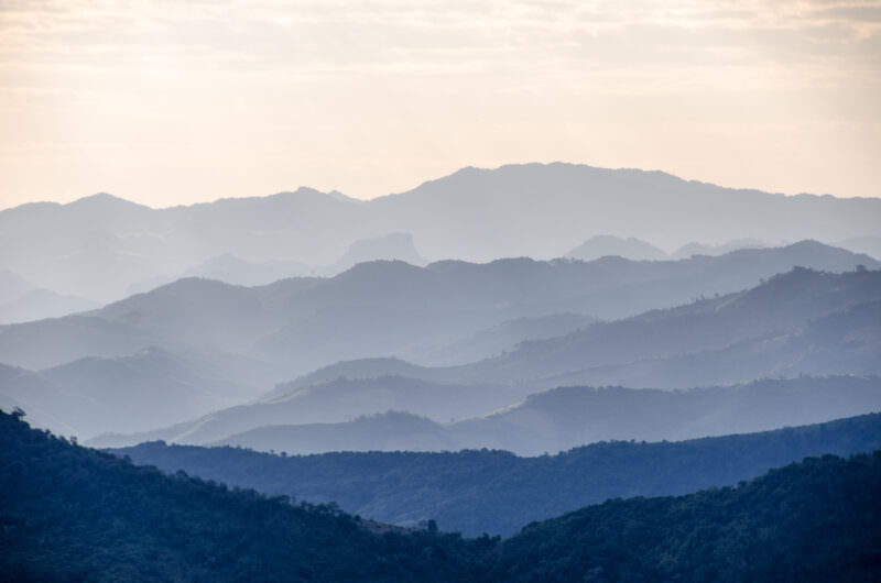
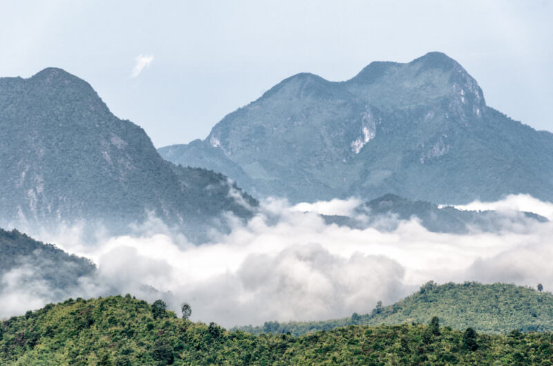
NORTHERN LAOS, Laos — Dense monsoon forests blanket the steep, folded ridges of the northern highlands, fading into a distant blue haze. This rugged topography covers over 70 percent of the country, a severe landscape that historically isolated highland ethnic groups and forced early trade networks to rely heavily on the Mekong River basin. Photo by David Coleman / Have Camera Will Travel
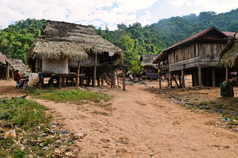
LUANG NAMTHA, Luang Namtha, Laos — A dirt road runs past traditional stilt houses in Lakkhamma Village. The elevated timber and thatch architecture protects living quarters from seasonal monsoon flooding and ground-dwelling pests while creating a shaded workspace underneath. The settlement was established as a joint Lao-European Commission development project to support rural infrastructure near the Nam Ha National Protected Area. Photo by David Coleman / Have Camera Will TravelLicense this image at:DirectlyAlamy
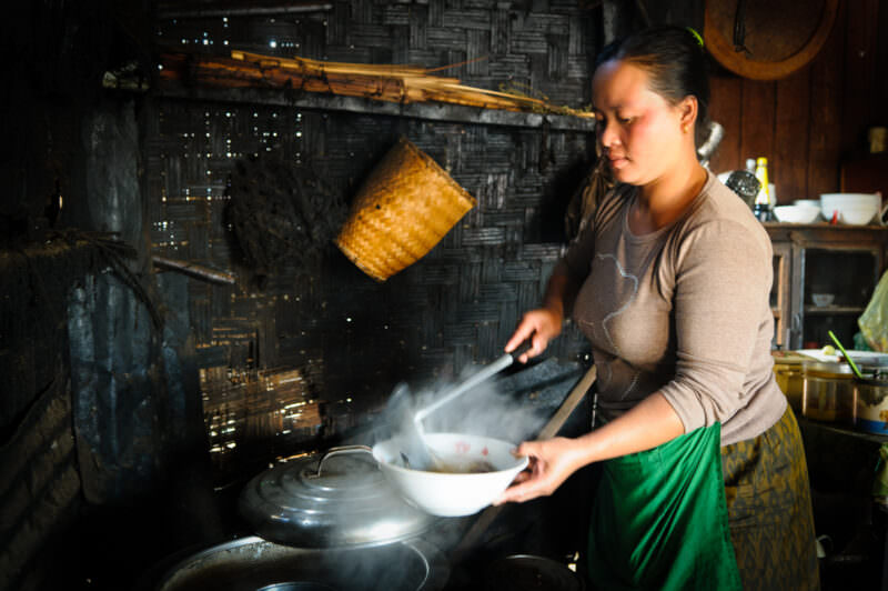
LUANG NAMTHA, Laos — A cook ladles steaming broth for pho inside a traditional kitchen in northwestern Laos. The woven bamboo walls behind her are heavily blackened by years of smoke from an unvented wood-fired stove. In rural Southeast Asian architecture, this continuous exposure to woodsmoke serves a structural purpose, curing the bamboo and acting as a natural fumigant against wood-boring insects. Photo by David Coleman / Have Camera Will TravelLicense this image at:DirectlyAlamy
LUANG NAMTHA, Laos — A weathered flag bearing the communist hammer and sickle flies from a bamboo pole in northern Laos. The emblem represents the Lao People’s Revolutionary Party, which has governed the country as a single-party socialist state since the abolition of the monarchy in 1975. The party banner is routinely flown alongside the national flag, reflecting a political monopoly that persists even as the nation pursues market-oriented economic reforms. Photo by David Coleman / Have Camera Will TravelLicense this image at:DirectlyAlamy
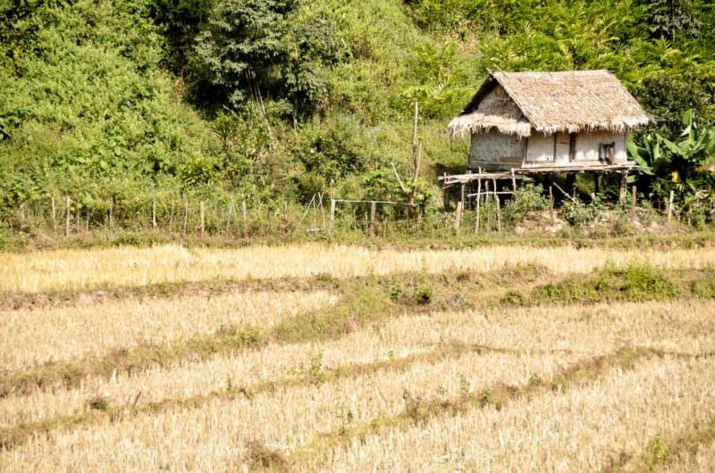
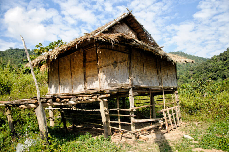
LUANG NAMTHA, Laos — A stilted bamboo hut overlooks a harvested rice paddy in this mountainous northern province. Elevating the structure on wooden pilings protects farmers and stored grain from seasonal monsoon floodwaters and ground-dwelling pests. The woven bamboo walls and thatched roof provide breathable vernacular architecture uniquely suited to the region’s tropical monsoon climate. Photo by David Coleman / Have Camera Will TravelLicense this image at:DirectlyAlamy
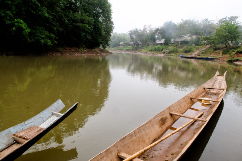
LUANG NAMTHA, Laos — Traditional wooden longboats rest along the banks of the Nam Tha River. The vessels’ narrow, shallow-draft hulls are specifically engineered to navigate the waterway’s severe seasonal depth fluctuations and rocky rapids. This river network functions as a primary transit corridor through the mountainous province, connecting remote ethnic communities to the provincial capital and the adjacent Nam Ha National Protected Area. Photo by David Coleman / Have Camera Will TravelLicense this image at:DirectlyAlamy
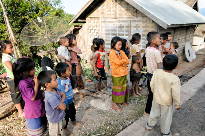
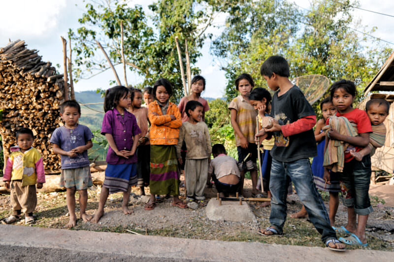
LUANG NAMTHA, Laos — Children gather outside a woven bamboo home in a rural village in northern Laos. A large mesh satellite dish installed beside the traditional structure highlights the rapid modernization of the province’s remote highland communities. This infrastructure increasingly connects historically isolated ethnic minority groups, such as the Khmu and Akha, to broader regional media networks. Photo by David Coleman / Have Camera Will TravelLicense this image at:DirectlyAlamy
LUANG NAMTHA, Laos — Flattened bamboo strips are woven into a lattice to form the wall of a house in Lakkhamma Village. To create these breathable panels, builders split and unroll tubular bamboo culms before weaving them into a flexible matrix that provides natural ventilation in the tropical heat. The settlement itself was established as a joint development project between the Lao government and the European Commission. Photo by David Coleman / Have Camera Will TravelLicense this image at:DirectlyAlamy
LUANG NAMTHA, Laos — A traditional woven bamboo rice storage hut stands elevated on wooden stilts in the mountainous terrain of northwestern Laos. The stilted construction isolates the harvested grain from ground moisture and foraging rodents, while the permeable woven bamboo walls ensure continuous air circulation. This vernacular design prevents rot and mold, securing the staple crop essential to the region’s agrarian economy. Photo by David Coleman / Have Camera Will TravelLicense this image at:DirectlyAlamy
LUANG NAMTHA, Laos — Harvested bird’s eye chilis (*Capsicum frutescens*) are spread in a dense layer to dry in the sun. The visible wrinkling occurs as moisture evaporates, a preservation technique that concentrates the peppers’ capsaicin and prevents rot. This process secures a year-round supply of the intense heat foundational to regional Lao staples like larb and jeow. Photo by David Coleman / Have Camera Will TravelLicense this image at:DirectlyAlamy
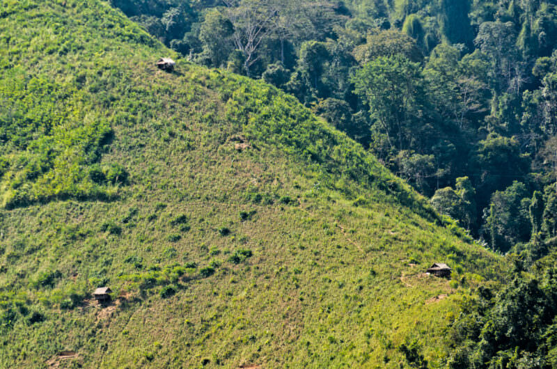
LUANG NAMTHA, Laos — Small bamboo huts dot a steeply cleared mountainside used for upland rice cultivation. Unlike the flooded terraces of the lowlands, these un-terraced slopes rely on rain-fed dry rice varieties adapted to well-drained soils. The temporary thatched shelters allow farmers to remain on-site during the labor-intensive harvest to protect their crops from foraging wildlife. Photo by David Coleman / Have Camera Will TravelLicense this image at:DirectlyAlamy
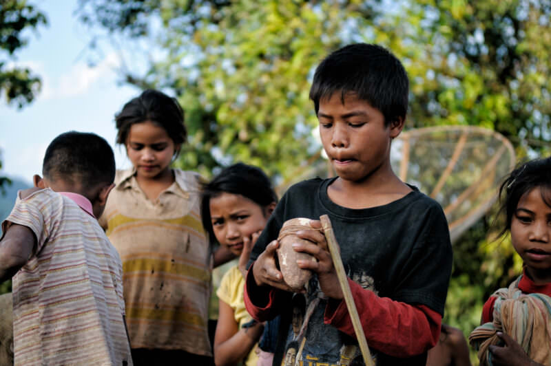
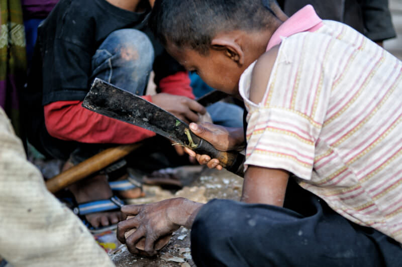
LUANG NAMTHA, Laos — A young boy wraps string around a hand-carved wooden top to prepare for a game of tujlub. This competitive string-hurled sport is a traditional fixture among ethnic communities in northern Laos. To survive high-impact collisions with opponents’ tops, players often reinforce the striking points of these handcrafted toys with repurposed metal, such as umbrella spines. Photo by David Coleman / Have Camera Will TravelLicense this image at:DirectlyAlamy
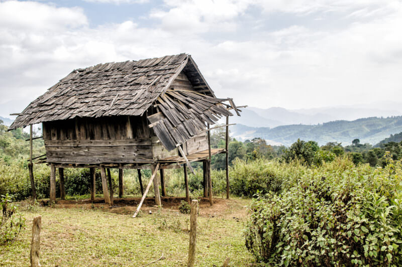
NORTHERN LAOS, Laos — A weathered wooden rice hut with a partially collapsed shingle roof stands elevated on timber stilts. Traditional Southeast Asian granaries are raised above ground level to protect the harvested crop from seasonal monsoon moisture and foraging rodents. The slatted wooden walls provide essential cross-ventilation, preventing rot and fungal growth in the stored grain before milling. Photo by David Coleman / Have Camera Will TravelLicense this image at:DirectlyAlamy
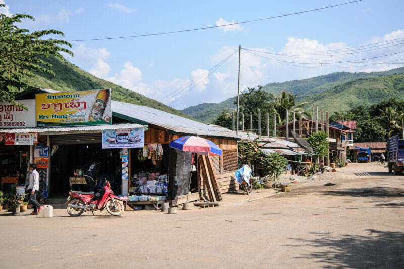
XIENG KHOUANG PROVINCE, Laos — A red motorbike sits parked outside Mrs. Pheng Restaurant, a wooden shopfront along an unpaved crossroads in the northern mountains. The prominent yellow Beerlao branding on the custom sign reflects the national brewery’s near-total dominance of the domestic market. By subsidizing storefront signage for rural vendors, the company secures ubiquitous advertising across Laos’s most remote regions. Photo by David Coleman / Have Camera Will TravelLicense this image at:DirectlyAlamy
LUANG NAMTHA, Laos — Cleared patches of upland rice fields break up the steep, forested mountains of northwestern Laos. Unlike lowland paddy farming, this rain-fed agricultural method requires no standing water or terracing, relying entirely on seasonal monsoons. The small bamboo huts visible on the slopes serve as temporary shelters, allowing farmers to avoid daily treks up the rugged terrain during labor-intensive harvest periods. Photo by David Coleman / Have Camera Will TravelLicense this image at:DirectlyAlamy
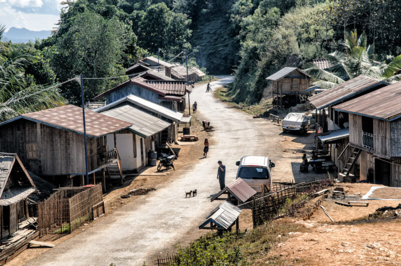
NORTHERN LAOS, Laos — Modest wooden dwellings cluster along a winding road carved through the country’s mountainous terrain. The traditional stilt architecture elevates the primary living spaces well above the ground. This vernacular design protects interiors from seasonal monsoon flooding and wildlife, while the shaded undercroft provides a naturally ventilated workspace and storage area during the tropical heat. Photo by David Coleman / Have Camera Will TravelLicense this image at:DirectlyAlamy
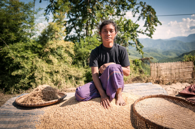
NORTHERN LAOS, Laos — A woman sits atop a tarp of drying paddy rice, preparing the harvested grain in a mountainous rural village. The shallow bamboo baskets beside her are traditional winnowing trays. Farmers use these to toss threshed grain into the air, allowing the breeze to carry away the lighter, inedible chaff while the heavier rice kernels fall back. Photo by David Coleman / Have Camera Will TravelLicense this image at:DirectlyAlamy
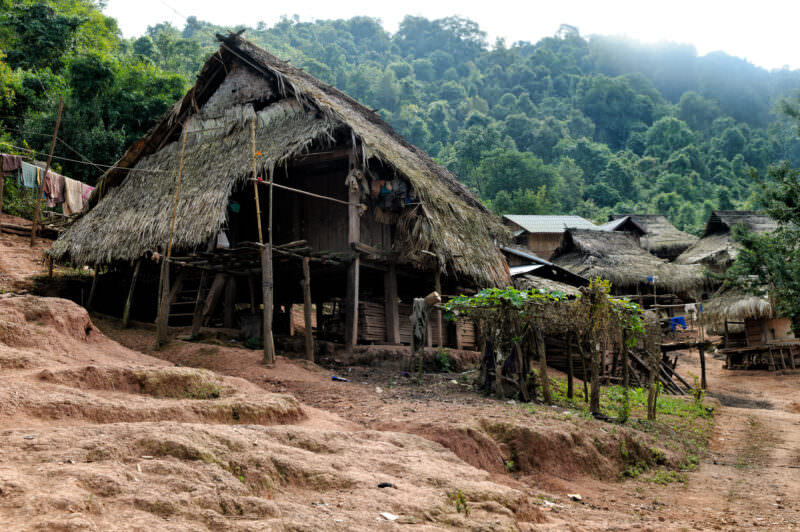
LUANG NAMTHA, Laos — Traditional thatched-roof stilt houses line a dirt hillside in Lakkhamma Village. Elevating homes on wooden pilings is a standard vernacular adaptation in Southeast Asia, designed to promote airflow in the tropical climate and protect living quarters from monsoon runoff and wildlife. The settlement was established as a joint rural development project between the Lao government and the European Commission near the Nam Ha National Protected Area. Photo by David Coleman / Have Camera Will TravelLicense this image at:DirectlyAlamy
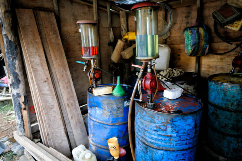
LUANG NAMTHA, Laos — Hand-cranked fuel pumps mounted on 55-gallon drums operate inside a roadside wooden shack. The transparent glass cylinders allow vendors to manually draw and visually measure exact fuel volumes before gravity-feeding it into motorcycle tanks. This mechanical, off-grid infrastructure remains essential in Laos’ mountainous northern province, where remote communities bordering China and Myanmar often lack the reliable electricity required for automated stations. Photo by David Coleman / Have Camera Will TravelLicense this image at:DirectlyAlamy
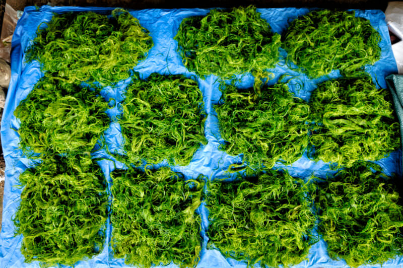
LUANG NAMTHA, Laos — Mounds of bright green river weed dry on a tarp at a local market. This filamentous freshwater alga, typically of the genus *Cladophora*, is harvested from shallow rivers during the regional dry season when water levels drop. Valued for its high protein and mineral content, the vegetation is preserved by drying before being fried or grilled as a staple in northern Lao cuisine. Photo by David Coleman / Have Camera Will TravelLicense this image at:DirectlyAlamy
NORTHERN LAOS, Laos — Layered mountain ridges recede into the distance, their silhouettes softened by a dense blue haze. This gradient of fading color is driven by atmospheric scattering, amplified here by high humidity and continuous moisture transpiration from the region’s broadleaf forests. The steep, folded topography characterizes the northern highlands, a rugged terrain that historically isolated upland communities and restricted agricultural development to narrow river valleys. Photo by David Coleman / Have Camera Will TravelLicense this image at:DirectlyAlamy
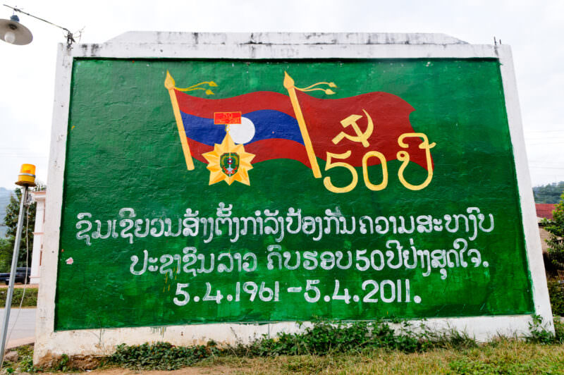
LUANG NAMTHA, Laos — A painted billboard commemorates the 50th anniversary of the Lao national police force. The inscribed dates mark the April 5, 1961 founding of the Lao People’s Public Security during the Laotian Civil War. The prominent display of the hammer and sickle alongside the national flag reflects the Marxist-Leninist ideology of the ruling Lao People’s Revolutionary Party, which took full control of the country in 1975. Photo by David Coleman / Have Camera Will TravelLicense this image at:DirectlyAlamy
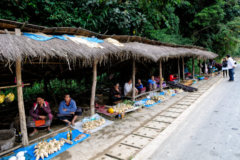
LUANG NAMTHA, Laos — Vendors display root vegetables, sugarcane, and bananas beneath a timber and thatch stall along a rural highway. These informal roadside markets function as primary economic conduits for the province’s diverse ethnic communities, including the Khmu and Hmong. By setting up along transit routes near the Nam Ha National Protected Area, local farmers and foragers bypass formal town markets to sell directly to travelers navigating the mountainous northwest. Photo by David Coleman / Have Camera Will TravelLicense this image at:DirectlyAlamy
LUANG NAMTHA, Laos — Chickens forage beneath a traditional stilted house with woven bamboo walls in Lakkhamma Village. Elevating the primary living quarters on wooden pilings protects residents from seasonal monsoon dampness while creating a shaded, ventilated enclosure for livestock below. The settlement was established through a joint development project between the Lao government and the European Commission to support rural infrastructure in the mountainous northern province. Photo by David Coleman / Have Camera Will TravelLicense this image at:DirectlyAlamy
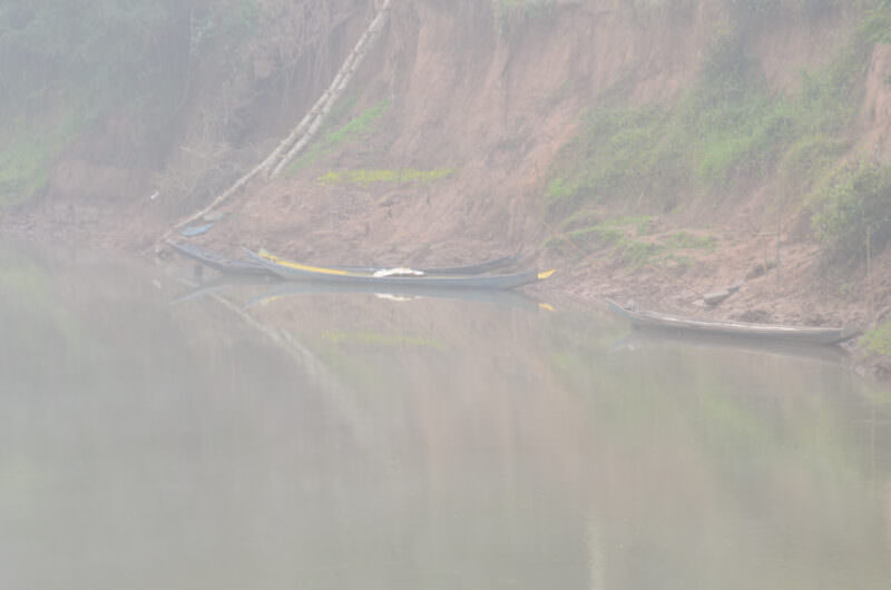
LUANG NAMTHA, Laos — Morning mist obscures traditional wooden longboats moored against the steep earthen banks of the Nam Tha River. The shallow-draft design of these vessels allows them to navigate the waterway’s seasonal fluctuations and rocky rapids. Flowing through mountainous terrain near the borders of China and Myanmar, the river serves as a critical transport artery linking remote ethnic communities to the Nam Ha National Protected Area. Photo by David Coleman / Have Camera Will TravelLicense this image at:DirectlyAlamy
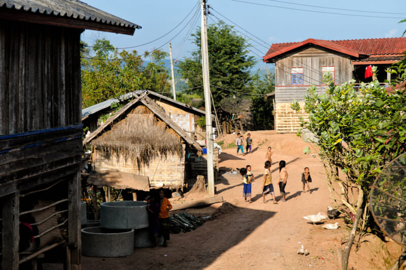
LUANG NAMTHA, Laos — Children gather on a dirt road among traditional stilted homes in a rural northern village. The elevated architecture, featuring woven bamboo walls, protects living quarters from monsoon flooding and foraging livestock while creating a shaded undercroft for storage. The juxtaposition of traditional thatch with corrugated metal roofs and satellite dishes reflects the rapid integration of modern infrastructure into historically isolated highland communities. Photo by David Coleman / Have Camera Will TravelLicense this image at:DirectlyAlamy
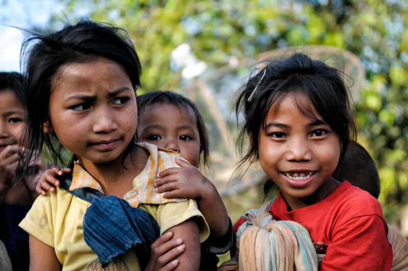
LUANG NAMTHA, Laos — Children from a rural ethnic minority community carry younger siblings in traditional cloth slings, standing before a mesh satellite dish. The background antenna marks the gradual modernization of Laos’s mountainous northern province, a gateway region bordering China and Myanmar. Despite the arrival of new telecommunications, Khmu, Hmong, and Akha families in these remote villages continue to rely on traditional communal childcare practices. Photo by David Coleman / Have Camera Will TravelLicense this image at:DirectlyAlamy
LUANG NAMTHA, Laos — Children gather to play a traditional top-spinning game in a highland village. The boy on the right holds a hand-carved wooden top and whip, tools for a customary sport central to the cultural festivals of local Hmong and Akha minority groups. Behind the group, a satellite dish stands beside stacked firewood, highlighting the intersection of subsistence agrarian life and growing modern connectivity in this remote northern province. Photo by David Coleman / Have Camera Will TravelLicense this image at:DirectlyAlamy
NORTHERN LAOS, Laos — Villagers gather outside traditional stilt homes set along a dirt road in a remote mountainous community. The structures utilize woven split-bamboo walls and wooden shingle roofs, vernacular adaptations designed to maximize cross-ventilation in the region’s tropical heat. Raising the primary living quarters on wooden pilings protects the interior from monsoon flooding while creating a shaded, multi-purpose workspace beneath the floorboards. Photo by David Coleman / Have Camera Will TravelLicense this image at:DirectlyAlamy
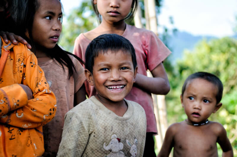
LUANG NAMTHA, Laos — A smiling boy stands with a group of children in a rural northern Lao village. The forested slopes in the background border the Nam Ha National Protected Area, a rugged region noted for its high ethnic diversity. These remote mountain communities are home to numerous minority populations, including the Khmu, Hmong, and Akha, who maintain traditional agrarian lifestyles. Photo by David Coleman / Have Camera Will TravelLicense this image at:DirectlyAlamy
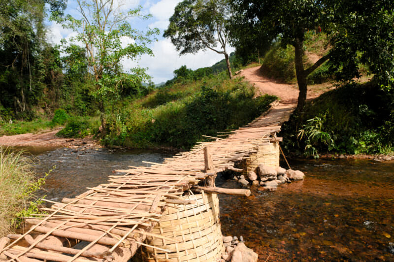
LUANG NAMTHA, Laos — A woven bamboo bridge spans a shallow creek along a dirt path leading to Lakkhamma Village. The structure’s piers utilize a traditional gabion technique, employing woven bamboo baskets filled with river stones. This permeable engineering allows water to flow through the supports during monsoon floods, creating a resilient, easily rebuilt crossing for communities near the Nam Ha National Protected Area. Photo by David Coleman / Have Camera Will TravelLicense this image at:DirectlyAlamy
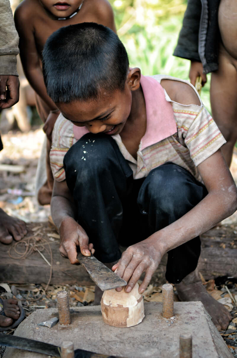
LUANG NAMTHA, Laos — A young boy uses a machete to shape a block of wood into a spinning top. He is roughing out the body for *tujlub*, a competitive string-hurled game popular among highland communities in northern Laos. Once carved, these heavy wooden tops are typically fitted with metal points salvaged from umbrella spines to withstand violent impacts when players hurl them to strike opponents’ tops. Photo by David Coleman / Have Camera Will TravelLicense this image at:DirectlyAlamy
NORTHERN LAOS, Laos — Valley fog settles between steep, heavily forested limestone peaks. These tower karsts are the result of millions of years of chemical weathering, where mildly acidic rainfall dissolves the soluble bedrock along structural fractures. Tectonic uplift across Southeast Asia elevated these ancient marine deposits, exposing them to the heavy monsoonal rains that carved their near-vertical profiles. Photo by David Coleman / Have Camera Will Travel
LUANG NAMTHA, Laos — A young boy uses a heavy blade to shape a wooden block into a spinning top on a makeshift concrete workbench. He is crafting a piece for tujlub, a competitive string-hurled top game popular in northern Laos. Players forcefully throw these heavy wooden tops to strike opponents’ pieces, often reinforcing the spinning points with salvaged metal like umbrella spines to withstand the high-impact collisions. Photo by David Coleman / Have Camera Will TravelLicense this image at:DirectlyAlamy
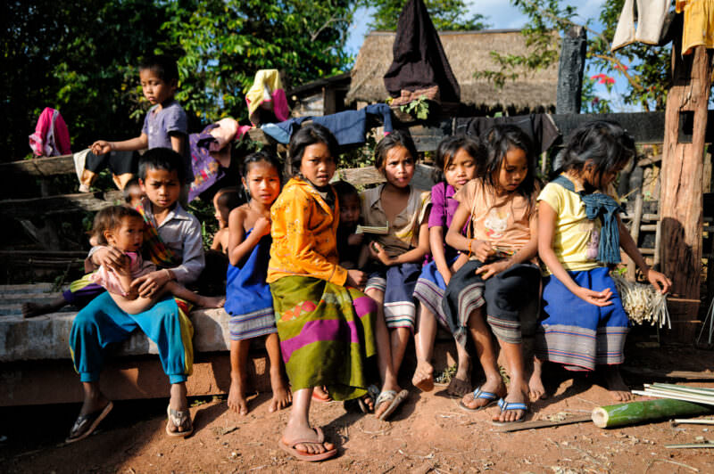
LUANG NAMTHA, Laos — Children gather on a low wall in a rural village in northern Laos. Several girls wear the *sinh*, a traditional tubular skirt foundational to local dress. The distinctly woven horizontal patterns along the hemline, known as the *tin sinh*, historically serve as visual identifiers of specific ethnic affiliations among Luang Namtha’s diverse highland communities. Photo by David Coleman / Have Camera Will TravelLicense this image at:DirectlyAlamy
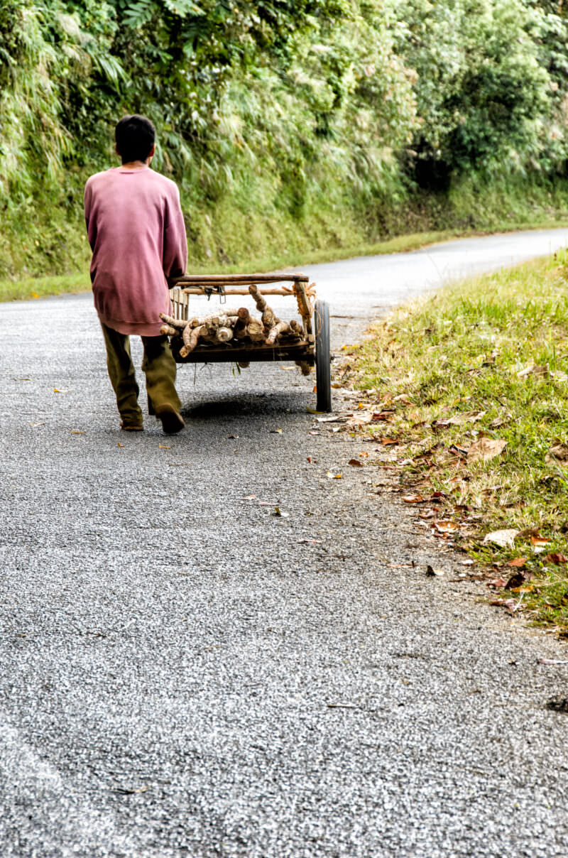
NORTHERN LAOS, Laos — A man pushes a wooden handcart loaded with gathered branches up a steep mountain road. Despite expanding electrification initiatives across the region, gathered firewood and charcoal remain the primary energy sources for domestic cooking in rural highland communities. Small-diameter wood like this is typically harvested from secondary forests or agricultural fallows to supply daily household fuel without felling mature timber. Photo by David Coleman / Have Camera Will TravelLicense this image at:DirectlyAlamy
Where is it?
Luang Namtha Province is located in the northwestern part of Laos.
The nearest major airport is Luang Prabang International Airport (LPQ) in Luang Prabang.
From Luang Prabang, travelers can take a bus or arrange private transportation to Luang Namtha town, which takes approximately 6-8 hours.
Within the province, local transportation options include tuk-tuks, songthaews, and bicycles for hire.
What to know before you go
There is a small airport in Luang Namtha, but in general, this isn’t somewhere you just turn up on a whim. There are some tourist lodgings, but in general, it doesn’t have a lot of infrastructure in place for foreign visitors. Much of the people coming in and out of the area are related to the Chinese companies in the area. Of course, being off the beaten tourist track definitely has its appeal.
Enjoyed this article? Personalize your search results.
I'm a freelance travel photographer based in Washington DC. Seven continents, up mountains, underwater, and a bunch of places in between. My images have appeared in numerous publications, and you can check out some of my gear reviews and tips here. More »