Towamba River Valley, a Beautiful Spot in the Australian Outback
TOWAMBA, Australia — The Towamba Valley is nestled between state forests and national parks and yet still only half an hour to the stunning Sapphire Coast, at that. Adding to the charm is that it’s just not that easy to get to. And that’s just the way the locals like it.
Australia’s a big place. It’s roughly the size of the continental United States, give or take, but has a population smaller than Texas. That leaves a lot to explore.
On a recent trip, I headed out to a beautiful corner of the country, well off the beaten track. Not far from the Snowy Mountains (ie. of The Man From Snowy River movie fame) and tucked down near where the New South Wales and Victorian border meets the Pacific Ocean, the Towamba Valley is nestled between state forests and national parks and yet still within reasonable driving distance to the coast — and the stunning Sapphire Coast, at that.
Adding to the charm is that it’s just not that easy to get to — some sections of the road are sealed, but most of it is not. And that’s just the way the locals like it.
Since the valley has not yet been developed for industrial farming and the valley is surrounded by forests, wildlife is still aplenty. Kangaroos, emus, wombats, cockatoos, and kookaburras are all abundant throughout the area. While not exactly a pristine forest, the valley nevertheless retains a sleepy and cozy charm.
Have Camera Will Travel // Newsletter
Practical field notes, hands-on gear tests.
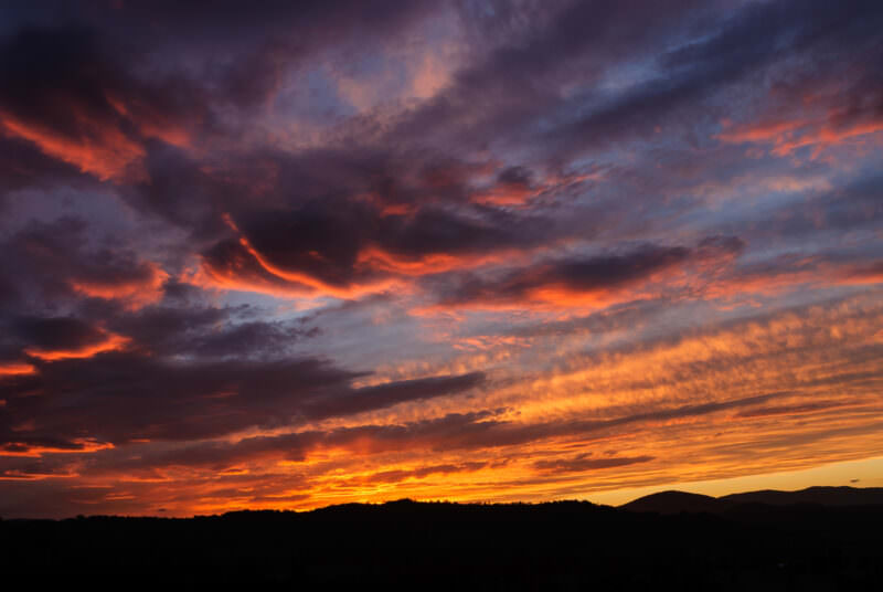
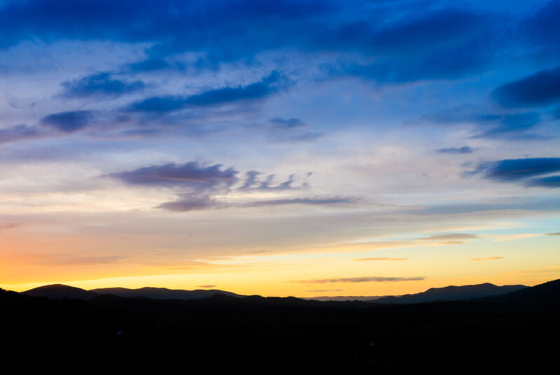
This beautiful sunset shot, taken just after the sun has disappeared behind the mountain ranges, looks straight down the Towamba valley from Towamba. It’s actually basically the same vantage point as the timelapse video below.
The Towamba River
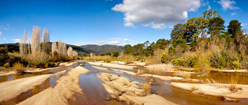
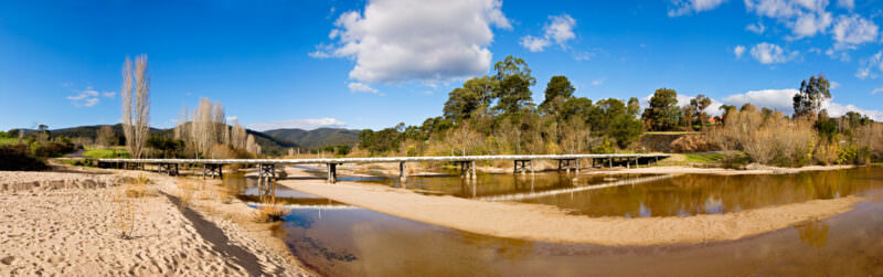
Like many river systems throughout the Australian outback, the Towamba River is prone to extremes. This shot, taken on an earlier visit, shows it pretty dry, but the drought more recently reduced it to not much more than a giant sand pit. I’ve never been there when it floods, but when it does it completely cuts off the village of Towamba from the outside world.
Towamba village
Like the string of settlements along the valley such as Rocky Hall and Burragate, Towamba (not to be confused with Toowoomba, which is in southeast Queensland), is more a village than a town — its recorded population is just over 200. Towamba itself dates back to the 1840s when it was established as a stop on the track between the shipping interests and farmlands on the Monaro plateau of local entrepreneur and land magnate Ben Boyd who managed to leave his fingerprints, progeny, and the occasional self-commissioned shrine throughout the region.
Photos of Towamba
TOWAMBA, New South Wales, Australia — Mid-level altocumulus clouds reflect the setting sun above the silhouetted ranges of the Far South Coast. The brilliant reds and oranges are a product of Rayleigh scattering, an optical phenomenon where the thicker atmosphere at the horizon filters out shorter blue wavelengths. The darkened peaks below belong to the rugged foothills of the Great Dividing Range, forming the catchment for the eastward-flowing Towamba River. Photo by David Coleman / Have Camera Will Travel
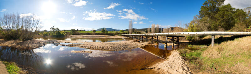
TOWAMBA, New South Wales — A low-level bridge crosses the wide, sandy bed of the Towamba River. Timber debris caught against the structural pylons marks the water height from recent catchment flooding. Crossings in rural Australian floodplains are frequently built as submersible bridges, engineered to allow sudden surges from East Coast Low weather systems to flow directly over the deck rather than washing the structure away. Photo by David Coleman / Have Camera Will TravelLicense this image at:Directly
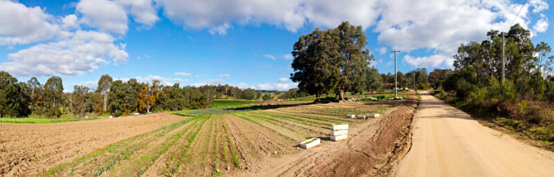
TOWAMBA, Australia — A dirt road borders freshly tilled furrows and young crops on a farm in the Towamba River valley. The large eucalyptus standing alone in the cleared field functions as a traditional Australian paddock tree. Historically spared during agricultural expansion to provide shade for livestock, these isolated native hardwoods now serve as critical ecological stepping stones for wildlife navigating modified landscapes. Photo by David Coleman / Have Camera Will TravelLicense this image at:DirectlyAlamy
TOWAMBA, New South Wales — Shallow channels weave through the exposed sandbanks of the partly dry Towamba River. This braided, low-flow state characterizes southeastern Australia’s coastal catchments, where river discharge fluctuates drastically between cyclical droughts and floods. Along the left bank, introduced deciduous trees stand bare against the native evergreen eucalypts, highlighting the contrast between imported European species and the drought-adapted flora that dominates the surrounding hills. Photo by David Coleman / Have Camera Will TravelLicense this image at:Directly
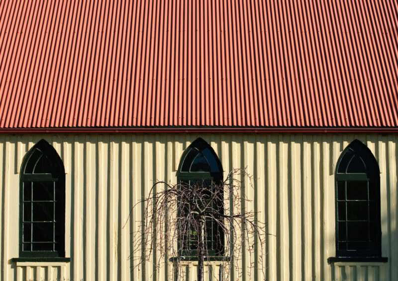
TOWAMBA, New South Wales — Three pointed Gothic windows punctuate the board-and-batten timber facade of a rural church beneath a red corrugated iron roof. This pairing of traditional ecclesiastical shapes with utilitarian materials typifies the Australian adaptation of Carpenter Gothic architecture. Remote pioneer settlements substituted traditional European stone with affordable, easily transported galvanized iron and locally milled timber to quickly establish a community presence. Photo by David Coleman / Have Camera Will TravelLicense this image at:DirectlyAlamy
TOWAMBA, Australia — Mid-level clouds glow pink and orange above the silhouetted ridges of the Towamba valley at sunset. The vibrant hues result from Rayleigh scattering, an optical phenomenon where the sun’s low horizon angle forces light through a thicker layer of atmosphere. This process scatters shorter blue wavelengths, allowing only the longer red and orange light waves to penetrate and illuminate the undersides of the altocumulus cloud deck. Photo by David Coleman / Have Camera Will TravelLicense this image at:Directly
TOWAMBA, New South Wales — A low-level timber bridge spans the shallow channels and wide sand banks of the Towamba River. The extensive sediment deposits reflect the region’s highly variable hydrology, driven by episodic coastal rains. The bridge’s low-clearance trestle design is a rural engineering adaptation built to allow sudden floodwaters and debris to wash safely over the deck rather than battering the structure apart. Photo by David Coleman / Have Camera Will Travel
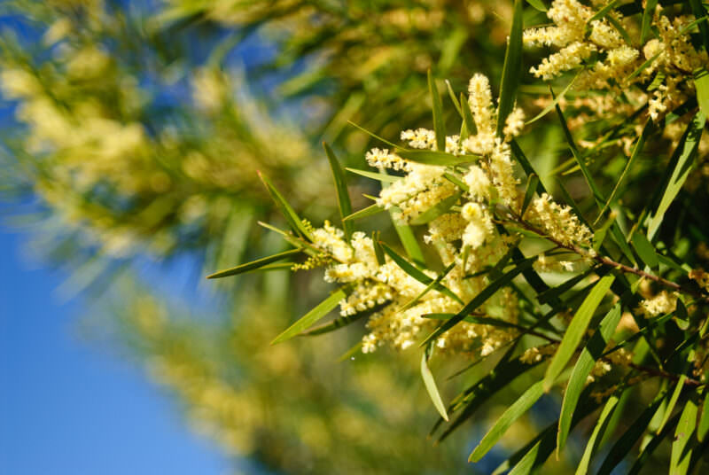
TOWAMBA, New South Wales — Cylindrical flower spikes of a Sydney Golden Wattle (Acacia longifolia) bloom alongside the plant’s flat green foliage. What appear to be true leaves are actually phyllodes, flattened leaf stems that evolved to perform photosynthesis while minimizing water loss in harsh coastal environments. Native to southeastern Australia, the fast-growing shrub has become highly invasive in similar climates globally. Photo by David Coleman / Have Camera Will TravelLicense this image at:DirectlyAlamy
TOWAMBA, New South Wales — A sunset transitions from warm horizon yellows to deep blues over a silhouetted mountain landscape. These peaks belong to the southern reaches of the Great Dividing Range. The massive cordillera parallels the eastern coast, dictating the regional climate by trapping Pacific moisture and casting a vast rain shadow across the Australian interior. Photo by David Coleman / Have Camera Will TravelLicense this image at:DirectlyAlamy
Getting here
Since unsealed roads are unavoidable and the roads are graded infrequently, a 4WD is recommended. Don’t expect any hotels, petrol stations, corner stores, or pubs. Your best bet for accessing the area is to head out from Bega, Merimbula, Eden, or Bombala. And watch out for wombats.
Map
Towamba NSW 2550, Australia
Enjoyed this article? Personalize your search results.
I'm a freelance travel photographer based in Washington DC. Seven continents, up mountains, underwater, and a bunch of places in between. My images have appeared in numerous publications, and you can check out some of my gear reviews and tips here. More »