Above the African Plains: Our Kilimanjaro Climb Diary
Just over 200 miles from the equator, we stood shivering in fleeces and gloves atop Kilimanjaro, surrounded by snow, ice, and volcanic rock, looking out over the plains of Tanzania and Kenya far below. This is our day-by-day account of the week-long Lemosho Route climb, with photos and gear notes from each stage.
We’re in the heart of Africa. The equator is only a little over 200 miles to the north. To the west and south, we’re looking out over the plains of Tanzania with their lions, elephants, and giraffes, although the animals are all too far away for us to see. In the distance beyond the horizon are famous national parks like the Serengeti and the Ngorongoro Crater. To the north and east, we’re looking right over the border into Kenya.
We should be baking in the hot African sun. But instead, we’re shivering despite our fleeces, gloves, and cold-weather jackets. We’re surrounded by snow and ice and volcanic rock.
We’re on top of Mount Kilimanjaro. 19,341 feet. At this altitude, each breath only provides half the amount of oxygen to the body that it would at sea level. It’s no wonder that we’re lightheaded, breathing hard, and tired. But the view is spectacular.
It’s taken us a week of trekking to get here. Here’s how we climbed this magnificent mountain.
Have Camera Will Travel // Newsletter
Practical field notes, hands-on gear tests.
I’ve put together a climb diary with photos from each day, as well as some gear tips for Kilimanjaro and what to expect from your climb.
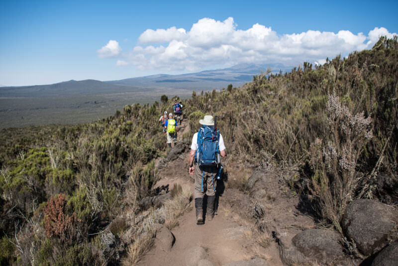
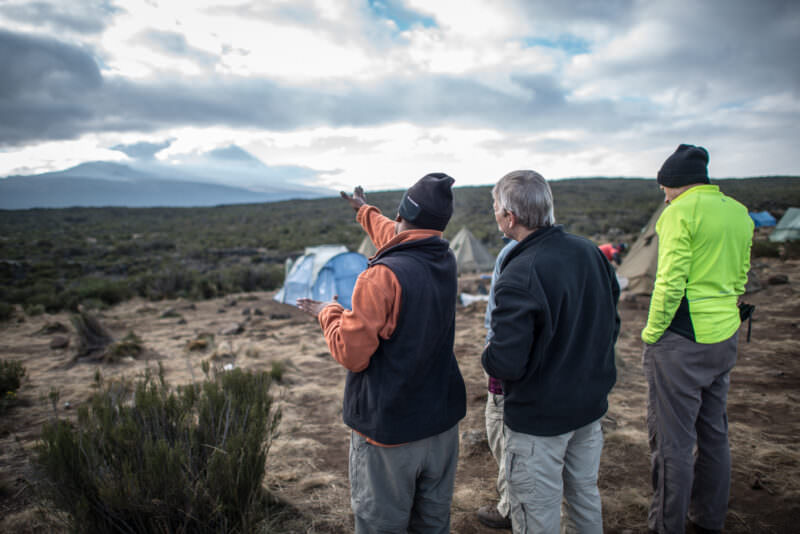
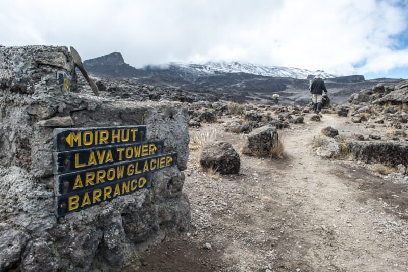
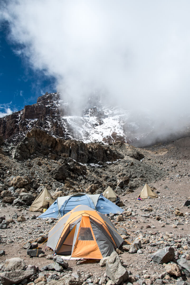
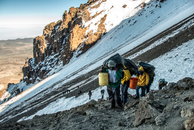
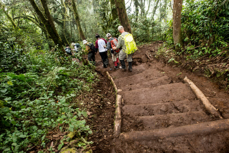
MOUNT KILIMANJARO, Tanzania — Hikers and a porter file along a forest trail near the Lemosho Glades Trailhead, the western starting point for one of the mountain’s more gradual approaches. The path passes through montane rainforest, the wettest of Kilimanjaro’s five ecological zones, before climbing above roughly 9,000 feet (2,700 m) into heath and moorland. Photo by David Coleman / Have Camera Will TravelLicense this image at:DirectlyAlamyMOUNT KILIMANJARO, Tanzania — Hikers traverse the Lemosho Trail as it emerges onto the Shira Plateau. The surrounding heath zone marks the altitude where dense montane forest gives way to hardy shrubs like Erica arborea. The flat expanse ahead is the remnant caldera of Shira, the oldest of Kilimanjaro’s three volcanic cones, which collapsed roughly half a million years ago. Photo by David Coleman / Have Camera Will TravelLicense this image at:DirectlyAlamyMOUNT KILIMANJARO, Tanzania — A guide points trekkers toward Kibo’s summit dome from Shira 1 Camp, roughly 11,500 feet (3,505 m) up on the Shira Plateau. This flat expanse is the collapsed caldera of Shira, the oldest of the mountain’s three volcanic centers, dated to roughly 2.5 million years ago. The camp serves as an acclimatization stop on the western Lemosho route toward Africa’s 19,341-foot (5,895 m) summit. Photo by David Coleman / Have Camera Will TravelLicense this image at:DirectlyAlamyMOUNT KILIMANJARO, Tanzania — A trail marker at approximately 14,500 feet (4,420 m) directs trekkers along the Lemosho Route through the mountain’s alpine desert zone. The sign points toward Lava Tower, a prominent volcanic plug that serves as a critical acclimatization point. Climbers ascend to the tower before descending to sleep at Barranco Camp, utilizing a standard physiological strategy to adapt to decreasing oxygen levels. Photo by David Coleman / Have Camera Will TravelLicense this image at:DirectlyAlamyMOUNT KILIMANJARO, Tanzania — Tents cluster on the rocky expanse of Arrow Glacier Camp beneath the steep, snow-dusted face of the Western Breach. Situated at approximately 16,000 feet (4,877 m) along the Lemosho Route, this barren site positions climbers for their final summit attempt on Africa’s highest peak. The looming breach presents a challenging scramble through steep gullies, providing direct access to the 19,341-foot (5,895 m) crater rim. Photo by David Coleman / Have Camera Will TravelLicense this image at:DirectlyAlamyMOUNT KILIMANJARO, Tanzania — Porters carry water containers and duffel bags up the snow-streaked scree of the Western Breach, supplying climbers near the summit where no natural water source exists. This route crosses Kibo’s steep upper slopes toward the crater rim, a stretch of the mountain that rises to Uhuru Peak at 19,341 feet (5,895 m), the highest point in Africa. Photo by David Coleman / Have Camera Will TravelLicense this image at:DirectlyAlamyARUSHA, Tanzania — Trekkers gather around the signboards marking Uhuru Peak, the 19,341-foot (5,895 m) summit of Mount Kilimanjaro. The marker sits on the rim of Kibo crater, the highest of the mountain’s three volcanic cones. Ascending to this barren expanse of volcanic rock and snow completes the climb of the African continent’s highest point and one of the world’s Seven Summits. Photo by David Coleman / Have Camera Will TravelLicense this image at:DirectlyAlamyMOUNT KILIMANJARO, Tanzania — A line of hikers picks its way down log-reinforced earthen steps below Mweka Camp, a stretch of the Mweka Route that carries climbers through montane forest on their final descent. The trail leads to Mweka Gate at 5,381 feet (1,640 m), where expeditions officially end and successful trekkers receive summit certificates. Porters and guides typically accompany groups on this well-trodden path. Photo by David Coleman / Have Camera Will TravelLicense this image at:DirectlyAlamy
Enjoyed this article? Personalize your search results.
I'm a freelance travel photographer based in Washington DC. Seven continents, up mountains, underwater, and a bunch of places in between. My images have appeared in numerous publications, and you can check out some of my gear reviews and tips here. More »