LADY ELLIOT ISLAND, Australia — Ever fancied a pre-breakfast swim with turtles and manta rays? If you’ve ever had a hankering to get up close and personal with Australia’s extraordinary Great Barrier Reef, there aren’t many better ways than a trip to Lady Elliot Island Resort.
Ever fancied a pre-breakfast swim with turtles and manta rays? If you’ve ever had a hankering to get up close and personal with Australia’s extraordinary Great Barrier Reef and are willing to forgo some of the mod cons of fancy resorts, there aren’t many better ways than a trip to Lady Elliot Island Eco Resort. Short of chartering your own boat with a local expert captain, I can’t think of too many better ways to spend some quality time on the reef. I’ve been a couple of times now — several years apart — and while it’s not going to be everyone’s cup of tea, I know I’ll be back.
One of Australia’s 8222 islands, as far as coral cays go, Lady Elliot Island is pretty big — many are only a few feet or yards across. But it’s still really just a speck in the ocean about 56 miles (90 km) north-east of Bundaberg and about 93 miles (150 km) east-south-east of Gladstone on Queensland’s coast. It’s the southernmost island on the long chain of the Great Barrier Reef and the only one with an airstrip. But it’s also been a speck with a notoriously fatal attraction to ships, earning the island the nickname of “Shipwreck Island.” Over the last century and a half, a surprising number of vessels have come to grief on the island’s reefs despite the presence of a lighthouse, and it’s not unknown for tourists staying on the island to lend a hand rescuing shipwrecked seafarers. In 1980 alone, two sailing yachts wrecked on the island and timbers salvaged from the wrecks now form parts of the resort’s bar — the Thisby and the famous maxi racing yacht Apollo, which only two years previously had won the Sydney-to-Hobart yacht race.1
The tone of the resort is strong on eco-sensibilities, and minimizing environmental impact is taken very seriously. The area is for all intents and purposes a pristine marine habitat; the island is within a Marine National Park Zone on the southern end of the Great Barrier Reef Marine Park. The number of guests on the island is strictly controlled, which is just as well since the island is small — a leisurely stroll around the entire perimeter of the island takes an hour give or take. Put another way, at about 35 to 45 hectares it’s roughly six to eight times the size of the Melbourne Cricket Ground. The limit on the number of visitors makes sure that it never feels the least bit crowded. It also means an exceptionally high wildlife-to-human ratio.
Spectacular snorkeling & diving
Much of the island is surrounded by a shallow lagoon. At low tide, it’s a bit too shallow to swim comfortably, but once the tide comes in, it creates a wonderful, safe place to explore the reef shallows protected from the surf and ocean swells. And while green turtles cross the lagoon during the night to lay their eggs on the beach, it’s not deep enough to entice other big marine critters that might make skittish snorkelers nervous.
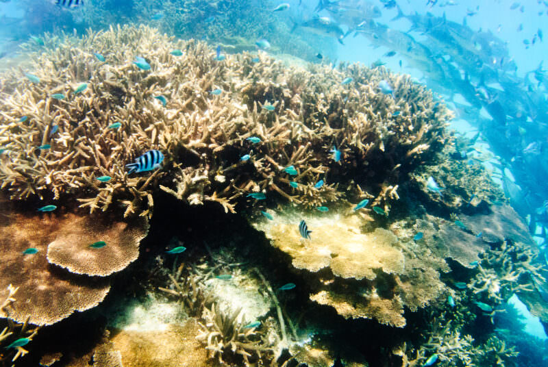
On the island’s northeast corner, the lagoon gives way to deeper water, creating an area that has some of the Great Barrier Reef’s best scuba diving and snorkeling with an incredible variety of marine life. And since fishing isn’t allowed, fish and marine life of all sizes are really able to flourish.
Within common sense limits, you can pretty much explore anywhere. I love being able to wake up in the morning, grab my mask and fins, walk 50 feet across a sandy beach, and head out for an early morning snorkel. There are also regular glass-bottomed boat trips that will save you some of the effort in swimming out into the deeper water, but for all intents and purposes, you can snorkel where you want when you want. If you’ve got a big enough supply of sunscreen, there’s nothing stopping you from snorkeling from dawn to dusk.
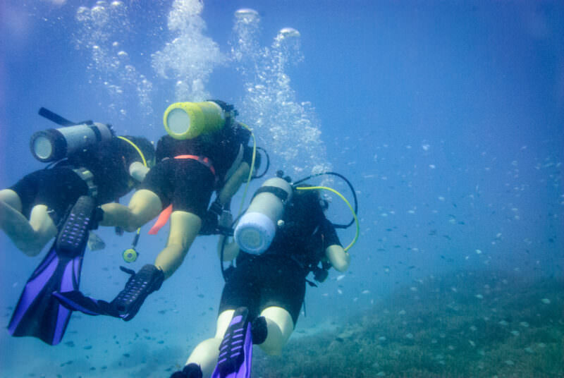
There are also regular scuba dives, including ‘adventure’ introductory dives that you don’t need a dive card to do, that take you out to some of the coral bommies quite close inshore in about 30-40 feet of water. And if you do have a dive card and want to really get a unique and spectacular perspective on the reef, I recommend doing one of the night dives — it is probably the most memorable dive I’ve ever done, like something out of a science fiction movie.
Have Camera Will Travel // Newsletter
Practical field notes, hands-on gear tests.
The locals
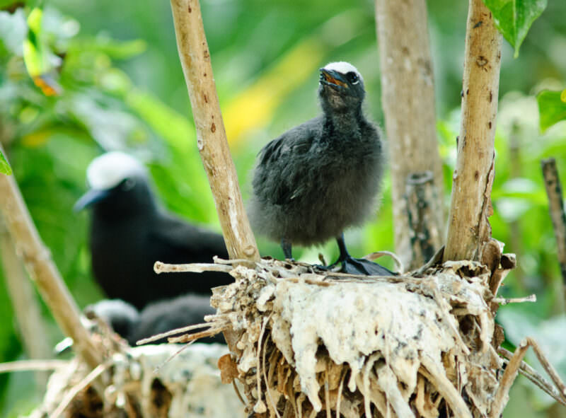
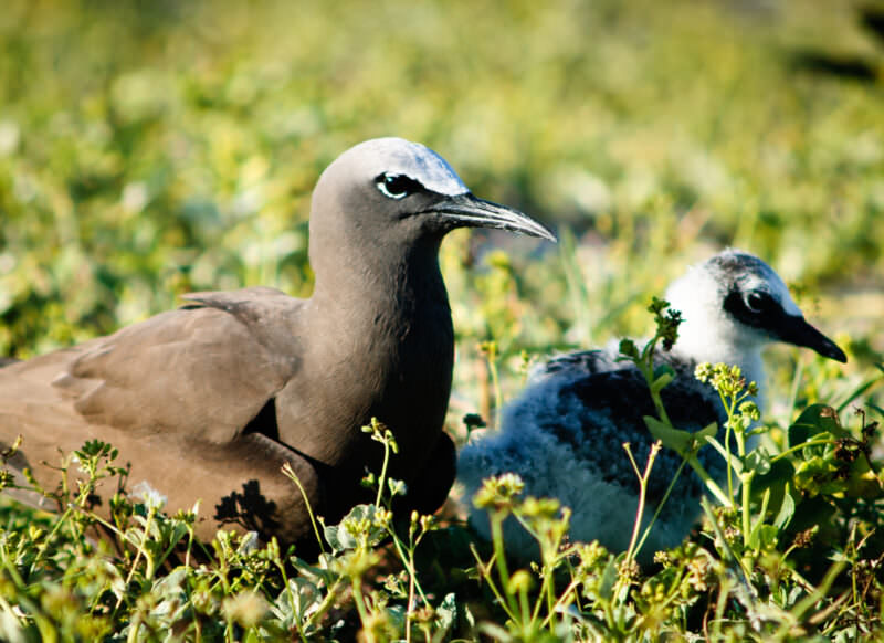
Lady Elliot is a place where the locals run the show. And in this case, that means the local wildlife. It’s very much a living nature preserve both in the water and above it. If a few tens of thousands of seabirds decide that they’re going to overrun the island for a while to nest, well, no one’s going to stop them, and you’d sure better get used to all the fun sounds and smells they bring with them. 30-40 species of birds nest on the island each year, and from the late nineteenth century, Lady Elliot’s main claim to fame was as a rich source of phosphate — a few thousand years as a nesting destination had accumulated more than a little guano to mine for fertilizer. And that should tell you something of what’s involved in sharing the island with its feathered locals.
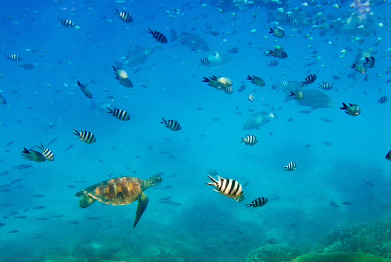
Green turtles coming up to the beach to lay their eggs during the night have right of way on the sand (come in March-April if you want to see the hatchlings fight their way down the beach to the water). And in the water, manta rays, turtles, fish, corals, and yes, the occasional reef shark, create a marine spectacle. And if you’re really lucky, you might happen upon some of the dozens of manta rays that frequent the waters around the island, sometimes up to 100 at a time. And if you’re very lucky indeed, you might even catch a glimpse of the ghost of Susannah McKee, wife of the lighthouse keeper, who committed suicide in 1907 and whose ghost island lore has still roaming the island.
Photos of Lady Elliot Island
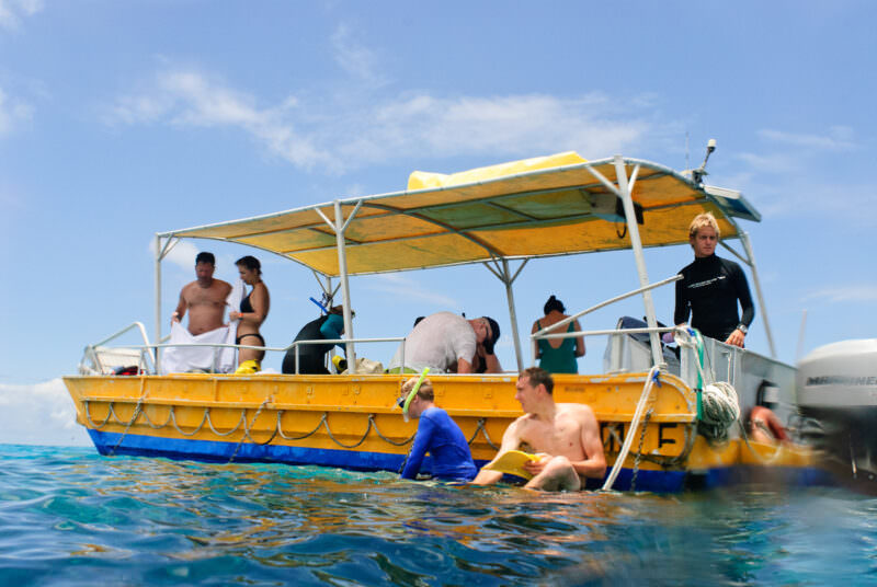
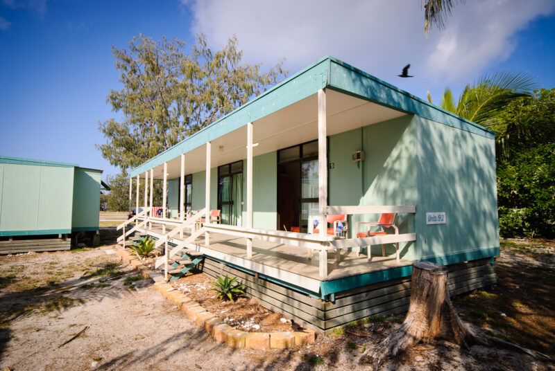
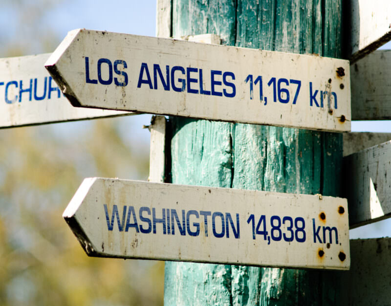
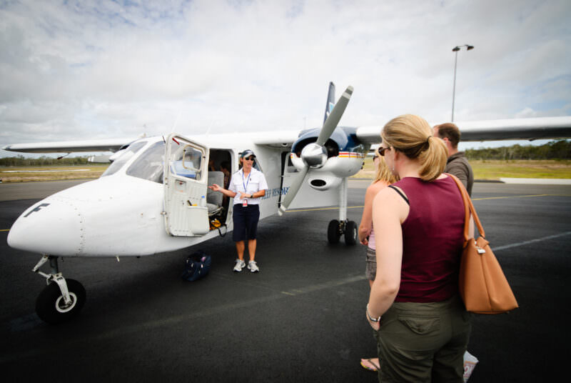
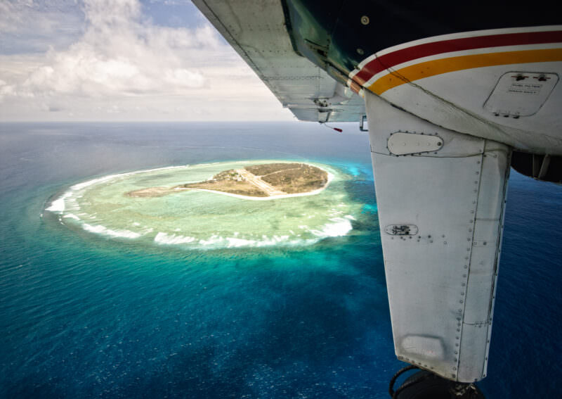
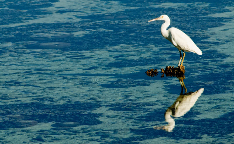
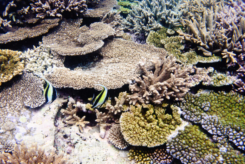
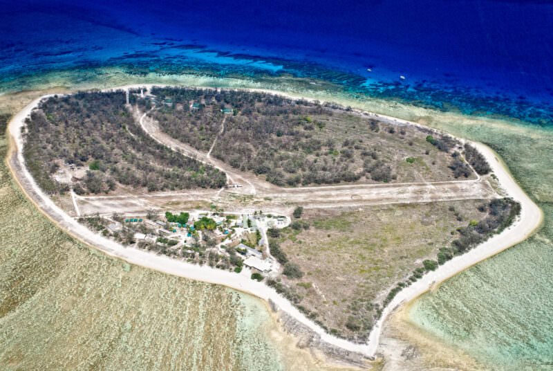
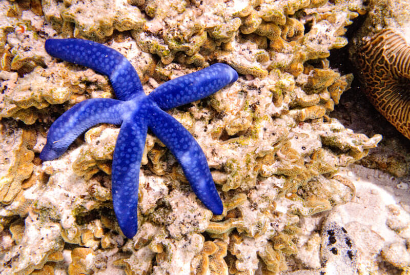
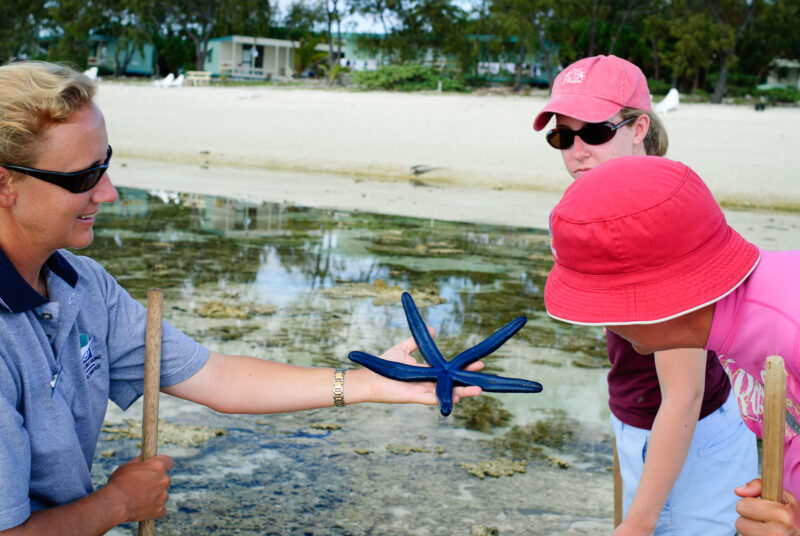
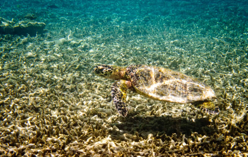
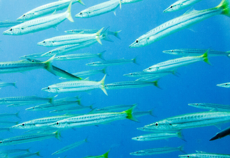
LADY ELLIOT ISLAND, Queensland, Australia — Snorkelers enter the water from a yellow glass-bottom boat off Lady Elliot Island, the southernmost coral cay of the Great Barrier Reef. The island lies about 56 miles (90 km) north-east of Bundaberg and is accessible only by light aircraft landing on a grass airstrip — an arrangement dating to 1969, when resort founder Don Adams built the strip in exchange for a tourism lease from the Commonwealth Department of Transport. The surrounding waters form a Marine National Park (Green) Zone, the highest level of protection in the Great Barrier Reef Marine Park, and the reef supports over 1,200 marine species. The island is part of the Great Barrier Reef World Heritage Area, inscribed by UNESCO in 1981. Photo by David Coleman / Have Camera Will TravelLicense this image at:DirectlyLADY ELLIOT ISLAND, Queensland, Australia — A green sea turtle swims among striped damselfish in the waters of the Great Barrier Reef. Lady Elliot Island anchors the extreme southern end of the reef system, and its beaches provide critical nesting habitat for Chelonia mydas, which returns each year between November and March. The surrounding Marine National Park (Green) Zone marks the beginning of a continuous reef system stretching over 1,430 miles (2,300 km) northward along the Queensland coast, within a World Heritage Area that IUCN has described as “probably the richest area in terms of faunal diversity in the world.” The island is also internationally recognized as the largest known reef-manta-ray aggregation site off eastern Australia. Photo by David Coleman / Have Camera Will TravelLicense this image at:DirectlyLADY ELLIOT ISLAND, Queensland, Australia — Modular accommodation units sit raised above the sandy soil at this eco-resort on the southern tip of the Great Barrier Reef. The lightweight, elevated construction minimizes the physical footprint on the fragile coral cay, protecting the island’s thin topsoil — stripped to bare coral rubble when roughly 20,000 tons of guano and about 3 feet (about 1 metre) of topsoil were dug out and shipped away between 1863 and 1873. Revegetation began in earnest only after feral goats were eradicated around 1961, and accelerated from 1969 under resort founder Don Adams; the Reef Islands Initiative has since replanted more than 15 acres (6 hectares) with over 11,400 native coral-cay species. Keeping the buildings off the ground also preserves the burrowing space required by the thousands of seabirds that nest across the sanctuary. Photo by David Coleman / Have Camera Will TravelLicense this image at:DirectlyLADY ELLIOT ISLAND, Queensland, Australia — Weathered directional signs mark the distances to Los Angeles and Washington from the southernmost coral cay in the Great Barrier Reef. The extreme distances underscore the geographic isolation of an island reached only by light aircraft on a grass airstrip, roughly 56 miles (90 km) northeast of Bundaberg. The surrounding waters are designated a Marine National Park (Green) Zone under both State and Commonwealth zoning plans, restricting fishing and extraction to protect a reef celebrated as the largest known reef-manta-ray aggregation site off eastern Australia, with overnight guest numbers capped at around 150. Photo by David Coleman / Have Camera Will TravelLicense this image at:DirectlyLADY ELLIOT ISLAND, Queensland, Australia — A White-capped Noddy (Anous minutus) chick stands on its nest in the southernmost coral cay of the Great Barrier Reef. The thick white material binding the branches is guano, which the seabirds use as a structural cement to construct stable nesting platforms in trees and shrubs. That same material is foundational to the island itself: the cay’s shingle ridges are bound together by phosphatic cement derived from centuries of accumulated seabird droppings, and the thin topsoil above was rebuilt only after seabirds and replanted vegetation returned following the guano-mining era of 1863 to 1873, when roughly a metre (3 ft) of surface material and about 20,000 tons of guano were excavated and shipped away. Located about 56 miles (90 km) north-east of Bundaberg, the island is a primary breeding site for the species within a strictly protected Marine National Park (Green) Zone. Photo by David Coleman / Have Camera Will TravelLicense this image at:DirectlyHERVEY BAY, Queensland, Australia — A pilot delivers a pre-flight briefing beside a twin-engine Britten-Norman Islander bound for Lady Elliot Island Eco Resort. The destination relies on Short Takeoff and Landing aircraft to navigate its unpaved grass airstrip, built by resort founder Don Adams beginning in 1969 as part of an agreement with the Commonwealth Department of Transport that exchanged a tourism lease for the airstrip’s construction. Operating without a boat marina protects the southernmost coral cay of the Great Barrier Reef, preserving the surrounding Marine National Park (Green) Zone waters for the island’s resident manta rays, nesting turtles, and seabirds. Lady Elliot lies roughly 56 miles (90 km) northeast of Bundaberg and marks the southern limit of the Great Barrier Reef World Heritage Area, inscribed by UNESCO in 1981. Photo by David Coleman / Have Camera Will TravelLicense this image at:DirectlyLADY ELLIOT ISLAND, Queensland, Australia — Scuba divers swim through the clear water column off the southernmost coral cay of the Great Barrier Reef. This exceptional visibility is a defining characteristic of Lady Elliot Island: as a storm-built shingle cay sitting close to the windward reef edge and composed entirely of coral rubble and bioclastic sediment, it generates none of the terrestrial runoff that clouds coastal and volcanic-island dive sites. The isolated landmass maintains pristine water conditions that allow over 1,200 marine species to thrive within the Marine National Park (Green) Zone. The island lies about 56 miles (90 km) north-east of Bundaberg and can be reached only by light aircraft. Photo by David Coleman / Have Camera Will TravelLicense this image at:DirectlyLADY ELLIOT ISLAND, Queensland, Australia — An adult White-capped Noddy and its chick rest in the low vegetation of this coral cay, the southernmost of the Great Barrier Reef. Located about 56 miles (90 km) north-east of Bundaberg, the island lies within a Marine National Park (Green) Zone and serves as critical breeding habitat for the species. The noddies drive a vital local nutrient cycle, depositing guano that sustains the native Pisonia forest canopy required for their own reproduction. That same guano-to-vegetation loop also underpins the island’s fragile topsoil — rebuilt only after seabirds and replanted trees returned following near-total destruction by guano mining between 1863 and 1873, when roughly a metre (3 ft) of soil was stripped away and about 20,000 tons of guano were shipped out. Photo by David Coleman / Have Camera Will TravelLicense this image at:DirectlyLADY ELLIOT ISLAND, Queensland, Australia — An unpaved grass airstrip bisects Lady Elliot Island, viewed past the wing strut of an approaching aircraft. The island is the southernmost coral cay of the Great Barrier Reef, lying about 56 miles (90 km) north-east of Bundaberg. A storm-built shingle cay rather than a sand cay, it sits at the southern tip of the Capricorn – Bunker group and is surrounded by a Marine National Park (Green) Zone protecting its diverse coral, nesting turtles, and the largest known reef-manta-ray aggregation site off eastern Australia. The grass airstrip itself has a place in the island’s history: it was built in 1969 by resort founder Don Adams under an agreement with the Commonwealth Department of Transport, exchanged for a tourism lease, and marks the beginning of the island’s transformation from guano-mined rubble into a functioning eco resort. Photo by David Coleman / Have Camera Will TravelLicense this image at:DirectlyLADY ELLIOT ISLAND, Queensland, Australia — A white heron perches on an exposed piece of coral in the shallow lagoon. The bird is a white morph of the Eastern Reef Egret (Egretta sacra), one of more than 100 bird species recorded at the island across the year. Lady Elliot is the southernmost coral cay of the Great Barrier Reef, lying about 90 miles (145 km) northeast of Bundaberg within a Marine National Park Green Zone where no fishing or extraction is permitted. The white morph’s bright coloration acts as camouflage against the sunlit coral sands, masking the wading predator from fish and crustaceans during low tide. Photo by David Coleman / Have Camera Will TravelLicense this image at:DirectlyLADY ELLIOT ISLAND, Queensland, Australia — Moorish idols navigate the hard coral formations surrounding Lady Elliot Island, the southernmost coral cay of the Great Barrier Reef. The prominent table corals of the Acropora genus grow horizontally to maximize sunlight absorption for their symbiotic algae, and this layered skeletal architecture is characteristic of the sheltered shallow bommies and sand patches on the island’s north-west side — the principal shore diving and snorkelling ground. The Moorish idol (Zanclus cornutus) uses its elongated tubular snout to extract sponges from narrow reef crevices, making these structurally complex formations essential foraging habitat. The surrounding waters are designated a Marine National Park (Green) Zone under both State and Commonwealth zoning plans, prohibiting all fishing and extraction. Photo by David Coleman / Have Camera Will TravelLicense this image at:DirectlyLADY ELLIOT ISLAND, Queensland, Australia — An unpaved grass airstrip bisects the coral cay, with the eco-resort clustered near the southern shore and the heritage lighthouse visible among the trees. The surrounding shallow lagoon drops abruptly into deep ocean waters at the extreme southern tip of the Great Barrier Reef, about 56 miles (90 km) north-east of Bundaberg. Lady Elliot is a storm-built shingle cay — formed from coral rubble, giant-clam shell and bioclastic sand cemented by phosphatic guano deposits — whose growth by shingle progradation began roughly 3,200 years ago. Between 1863 and 1873 the island was stripped of virtually all vegetation and mined for guano, with some 20,000 tons shipped away and about 3 feet (1 m) of topsoil removed, leaving a treeless rubble platform; revegetation did not take hold until feral goats were eradicated around 1961 and resort founder Don Adams accelerated replanting from 1969. The white tapering lighthouse, first lit in 1873, was the prototype of a series of 12 towers built in the Queensland Public Works Department’s distinctive composite style — a hardwood timber frame clad in curved riveted wrought-iron plates — and was placed on the Commonwealth Heritage List in 2004. Photo by David Coleman / Have Camera Will TravelLicense this image at:DirectlyLADY ELLIOT ISLAND, Queensland, Australia — A blue sea star (Linckia laevigata) rests on shallow hard corals at the southernmost coral cay of the Great Barrier Reef, about 56 miles (90 km) north-east of Bundaberg. The vivid coloration stems from a carotenoprotein called linckiacyanin. As a benthic scavenger, the invertebrate grazes on algae and microbial films, performing a vital reef-cleaning function within the Marine National Park (Green) Zone that protects these waters under both State and Commonwealth zoning. The island and its surrounding reef sit within the Great Barrier Reef World Heritage Area, inscribed by UNESCO in 1981 under all four natural criteria. Photo by David Coleman / Have Camera Will TravelLicense this image at:DirectlyLADY ELLIOT ISLAND, Queensland, Australia — A ranger guides visitors on a low-tide walk through the protected lagoon at the southernmost coral cay of the Great Barrier Reef, displaying a blue sea star. The Linckia laevigata is a widespread echinoderm that scavenges along the shallow coral rubble of the Indo-Pacific, relying on extreme regenerative abilities to survive predation — it is capable of regrowing an entire body from a single severed arm. The surrounding waters are zoned as a Marine National Park Green Zone under both State and Commonwealth plans, where no fishing or extraction is permitted, making guided reef walks one of the principal ways visitors engage directly with the marine life here. Photo by David Coleman / Have Camera Will TravelLicense this image at:DirectlyLADY ELLIOT ISLAND, Queensland, Australia — A green turtle (Chelonia mydas) swims over a dense field of branching coral at the southernmost coral cay of the Great Barrier Reef. Green and loggerhead turtles nest on the island’s beaches generally between November and March, and restoration work under the Reef Islands Initiative — delivered by the Great Barrier Reef Foundation with the eco resort — has produced a reported 125 percent increase in turtle nesting habitat at the main beach. More than 11,400 native coral-cay trees, plants and grasses have been planted across 15 hectares (37 acres) as part of that program. By grazing heavily on algae and seagrass, green turtles also prevent fast-growing vegetation from smothering the reef’s structural corals, maintaining the ecological balance of this protected Marine National Park (Green) Zone. Photo by David Coleman / Have Camera Will TravelLicense this image at:DirectlyLADY ELLIOT ISLAND, Queensland, Australia — A school of yellowtail barracuda navigates the waters of the Great Barrier Reef off Lady Elliot Island. While large barracuda are typically solitary ambush predators, smaller species such as Sphyraena flavicauda form dense aggregations like the one pictured. This synchronized schooling behavior creates a visual confusion effect that makes it difficult for larger predators to isolate and target an individual fish — an adaptive strategy well suited to the rich, current-driven waters surrounding this Marine National Park (Green) Zone. Photo by David Coleman / Have Camera Will TravelLicense this image at:DirectlyLADY ELLIOT ISLAND, Queensland, Australia — Small reef fish, including striped damselfish, navigate a dense thicket of branching and plate corals at the southernmost coral cay of the Great Barrier Reef. These hard corals secrete the calcium carbonate skeletons that construct the reef’s complex three-dimensional framework. The island itself was built over roughly 3,200 years from storm-deposited shingle ridges of coral fragments and giant clam shells, cemented together by guano-derived phosphatic compounds as seabird droppings mineralised the loose sediment across centuries. That same phosphatic layer made the island commercially attractive: between 1863 and 1873, approximately 20,000 tons of guano were mined and shipped away, stripping the cay of virtually all vegetation and removing roughly 3 feet (about 1 m) of topsoil. Photo by David Coleman / Have Camera Will TravelLicense this image at:Directly
What to know before you go to Lady Elliot Island
There’s only one way on and off the island: by small plane. You know you’re in for an adventure when you first see the plane that’s going to take you there. The one consolation is that you haven’t yet seen where it’s going to land on the island! After a few minutes of flying over beautiful blue water, the island comes into view and you get a good sense of just how remote it is, surrounded by nothing but water as far as you can see. The coral gravel landing strip goes across the middle of the island, with water on both ends. Thankfully, the pilots are all specialists on landing on and taking off from Lady Elliot. Flights leave from several points along Queensland’s southeast coast.
Lady Elliot Island, Queensland, Australia
Lady Elliot Island is not for everyone, and visitors will enjoy it far more if they go with realistic expectations. This is not a luxury resort where your every whim is catered to. They take the “eco” part of “eco-resort” seriously. That means no air conditioners — if it’s hot outside, it’s hot inside (time for a swim!). And this being just south of the Tropic of Capricorn, the difference between summer and winter is between hot and not-quite-so-hot. It also means very basic but functional accommodations. It means a basic dinner menu. There are no televisions in the rooms and you won’t get a cell phone signal. And if you don’t like sun and water or you’re looking to relax with a cocktail by the pool, you’re probably better off looking at other options like Port Douglas, the Whitsundays, or Heron Island. (For more logistical info on Lady Elliot Resort, check out their website.)
But if you want pristine coral reef, few fellow guests to trip over, and some of the most extraordinary array of marine life that the Great Barrier Reef has to offer, it’s an absolute pearler. You simply can’t get closer to one of the most stunning wonders of the natural world.
Notes & References:
“QLD’s ‘Shipwreck Island’ Gives Most Visitors a Quiet Welcome,” Courier-Mail, 6 January 1987. [↩︎]
Enjoyed this article? Personalize your search results.
I'm a freelance travel photographer based in Washington DC. Seven continents, up mountains, underwater, and a bunch of places in between. My images have appeared in numerous publications, and you can check out some of my gear reviews and tips here. More »