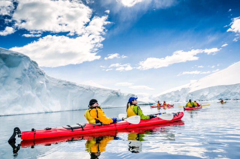
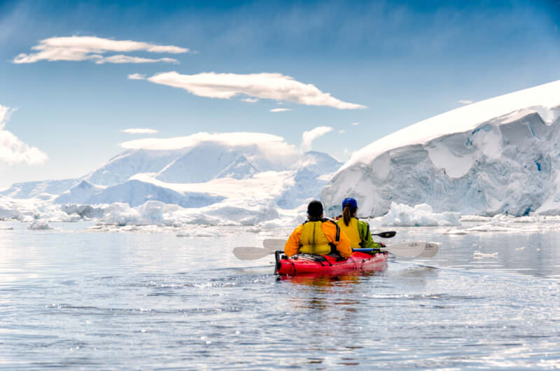
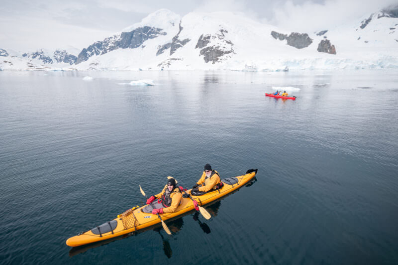
ANTARCTIC PENINSULA, Antarctica — There are worse places to be than gliding silently at water level amongst the icebergs, seals, and penguins of Antarctica.
There are worse places to be than gliding silently at water level amongst the icebergs, seals, and penguins of Antarctica. Exploring narrow and shallow passages that not even the zodiacs can pass through. Weaving through the brash ice. Looking down through the crystal-clear water. Drifting quietly by a leopard seal lounging on a small iceberg.
Craning your neck as precarious glacier cliffs tower above. Watching the playful penguins dart underneath the kayaks. Bracing yourself for a possible dunking as massive, curious elephant seals come up to nibble on the rudder. And if the breeze is in just the right direction and the ice carved just so, you might just be able to hear the icebergs sing.
Kayaking isn’t an option on every Antarctic cruise expedition, and it’s not going to be for everyone, but it is a wonderful and peaceful way to experience the stunning landscape and wildlife of the Antarctica Peninsula up close.
Photos of kayaking in Antarctica
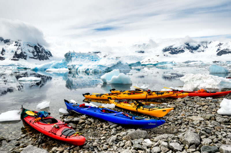
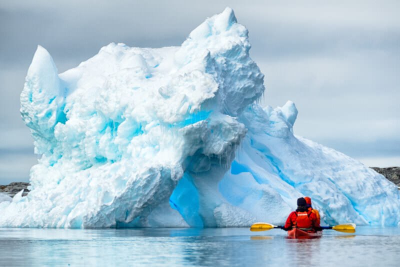
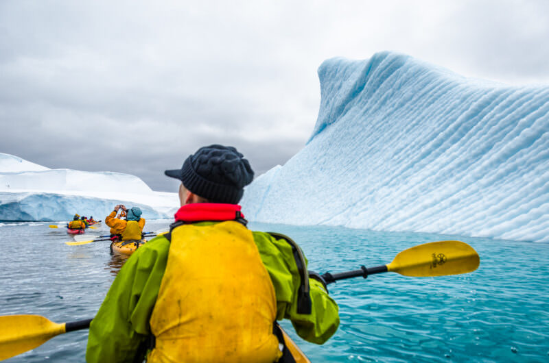
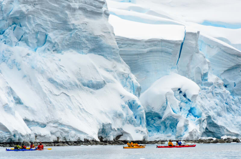
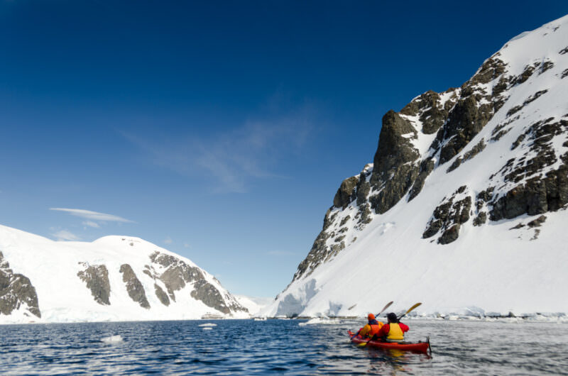
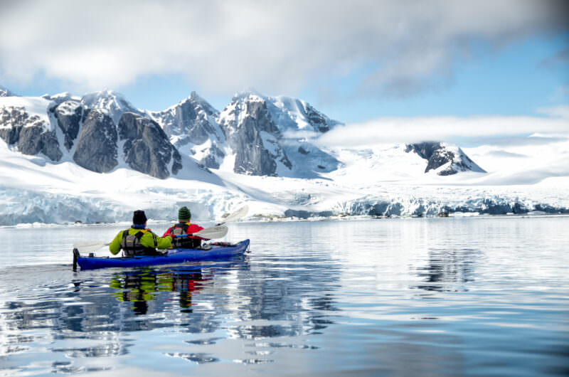
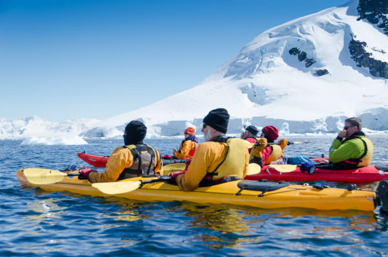
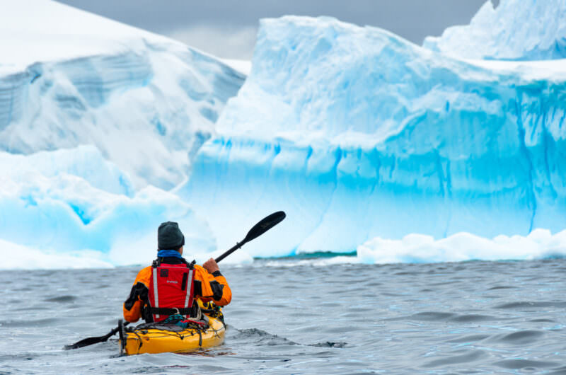
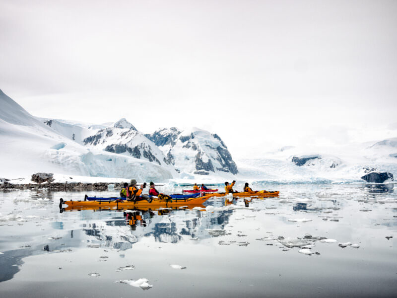
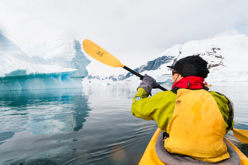
MELCHIOR ISLANDS, Antarctica — A solo kayaker navigates a narrow passage between towering blue icebergs in a bay at the Melchior Islands, part of the Palmer Archipelago off the western coast of the Antarctic Peninsula. The area is known for dramatic ice formations created when icebergs become grounded in the shallow waters of the bay, earning it the informal description of an “iceberg cemetery.” The distinctive blue coloration results from the compression of glacial ice crystals, which absorbs red wavelengths while reflecting blue. The Melchior Islands lie within the Gerlache Strait, which separates the Palmer Archipelago from Trinity Island and the Danco Coast of Graham Land — a channel first charted by Adrien de Gerlache aboard the Belgica in January and February 1898, and today one of the most travelled and most photographed waterways in Antarctica. Photo by David Coleman / Have Camera Will TravelLicense this image at:DirectlyAlamyNEKO HARBOUR, Antarctica — Kayakers navigate the calm waters of Neko Harbour, a small bay on the eastern shore of Andvord Bay on the Danco Coast of Graham Land, with towering glaciers, numerous icebergs, and dramatic snow-covered mountains rising on all sides. The harbour opens off the Gerlache Strait, the sheltered channel separating the Palmer Archipelago from the mainland peninsula, which was discovered and named by Belgian naval officer Adrien de Gerlache during the Belgian Antarctic Expedition of 1897 – 1899 — the first expedition to winter within the Antarctic Circle. Kayaking here provides an immersive perspective on the raw glacial landscape, and the harbour’s actively calving tidewater glacier means the conditions on the water are constantly in flux. Photo by David Coleman / Have Camera Will TravelLicense this image at:DirectlyAlamyCUVERVILLE ISLAND, Antarctica — Six expedition sea kayaks in red, blue, and yellow are beached on the cobble shore of Cuverville Island, with a calm iceberg-studded channel and glaciated Antarctic Peninsula mountains behind. The calm surface reflects a key hazard: growlers — low-floating chunks of glacial ice nearly awash and nearly invisible — make kayaking among Antarctic bergs a navigation exercise as much as a physical one. Photo by David Coleman / Have Camera Will TravelLicense this image at:DirectlyAlamyA pair of kayakers in a tandem kayak paddle near a large, dramatically carved blue iceberg at Petermann Island on the Antarctic Peninsula. Photo by David Coleman / Have Camera Will TravelLicense this image at:DirectlyAlamyMELCHIOR ISLANDS, Antarctica — A group of kayakers navigates through waters dotted with sculptural icebergs among the Melchior Islands in the Palmer Archipelago, off the western coast of the Antarctic Peninsula. The islands lie within the Gerlache Strait, the sheltered channel separating the Palmer Archipelago from Trinity Island and the Danco Coast of Graham Land, first charted by the Belgian Antarctic Expedition under Lieutenant Adrien de Gerlache de Gomery between 23 January and 13 February 1898, during which the party made about twenty landings and assigned roughly seventy new place-names to the surrounding features. De Gerlache originally named the channel the “Belgica Strait” after his ship; the expedition’s Scientific Commission later renamed it in his honour. The Belgica voyage — the first to overwinter within the Antarctic Circle, with Roald Amundsen among the crew — is considered the opening act of the Heroic Age of Antarctic exploration on the peninsula, and the Gerlache Strait remains one of the Southern Ocean’s premier wildlife corridors, drawing dense concentrations of humpback and Antarctic minke whales each austral summer. Photo by David Coleman / Have Camera Will TravelLicense this image at:DirectlyAlamyMELCHIOR ISLAND, Antarctic Peninsula — Kayakers in brightly colored drysuits navigate the shoreline beneath bulging glacial ice formations at Melchior Island on the western Antarctic Peninsula. The rounded, cauliflower-like protrusions visible at the cliff base form where meltwater refreezes under pressure, a sign of accelerated surface melt on a peninsula that has warmed faster than almost any region on Earth. Photo by David Coleman / Have Camera Will TravelLicense this image at:DirectlyAlamyCUVERVILLE ISLAND, Antarctica — Two kayakers in a tandem boat paddle along the base of a near-vertical rock and ice face in the channel beside Cuverville Island on a clear Antarctic summer day. At this latitude, mid-December delivers nearly 20 hours of usable daylight, allowing expedition operators to run kayak excursions well into the evening without artificial light. Photo by David Coleman / Have Camera Will TravelLicense this image at:DirectlyAlamyPETERMANN ISLAND, Antarctica — Kayakers paddle through glassy, mirror-like waters along the mountainous shoreline near Petermann Island in the Wilhelm Archipelago, just south of the Lemaire Channel on the western Antarctic Peninsula. The calm conditions offer near-perfect reflections of the snow-capped peaks against the grey polar sky. The island is named after the German geographer August Petermann and hosts overlapping colonies of Adélie and gentoo penguins at the edge of each species’ range, alongside blue-eyed shags and skuas. Photo by David Coleman / Have Camera Will TravelLicense this image at:DirectlyAlamyCUVERVILLE ISLAND, Antarctica — A group of expedition kayakers rafts together on the Errera Channel, with calved glacier ice and a heavily snow-loaded coastal range filling the middle distance. Cuverville Island hosts one of the largest gentoo penguin (Pygoscelis papua) colonies on the Antarctic Peninsula, though the birds are out of frame as the group scans the glacier face. Photo by David Coleman / Have Camera Will TravelLicense this image at:DirectlyAlamyNEKO HARBOUR, Antarctica — Kayakers navigate the calm waters of Neko Harbour, a small bay on the eastern shore of Andvord Bay on the Danco Coast of Graham Land, with towering glaciers, numerous icebergs, and dramatic snow-covered mountains as a backdrop. The harbour is one of the few sites where expedition ships land visitors directly on the Antarctic continental mainland rather than an offshore island — a distinction formally recognised among the site’s three defining features in the Antarctic Treaty Visitor Site Guidelines. The harbour takes its name from the Neko, a Chr. Salvesen & Co. floating whale-factory ship registered at Leith, Scotland, that used the sheltered bay as an anchorage across multiple seasons between 1911 – 12 and 1923 – 24; the name was applied by Scottish geologist David Ferguson in 1913 and formally approved by the United Kingdom on 22 September 1954. Photo by David Coleman / Have Camera Will TravelLicense this image at:DirectlyAlamyMELCHIOR ISLANDS, Antarctica — A sea kayaker in a dry suit and PFD paddles toward a massive calved iceberg near Melchior Island, western Antarctic Peninsula. The vivid blue color of the iceberg’s waterline face results from the extreme compression of ancient glacial ice, which expels nearly all air bubbles and absorbs red wavelengths, leaving only blue light to scatter back to the eye. Photo by David Coleman / Have Camera Will TravelLicense this image at:DirectlyAlamyCUVERVILLE ISLAND, Antarctica — A group of kayakers navigates through glassy waters dotted with brash ice at Cuverville Island on the Antarctic Peninsula. The calm conditions and scattered ice fragments offer a distinctive paddling experience, allowing visitors to explore the pristine Antarctic coastal environment at close range. Cuverville Island, situated in the Errera Channel between Rongé Island and the Arctowski Peninsula, is a popular destination for expedition cruises during the Antarctic summer season, known for its large gentoo penguin colony and dramatic glaciated scenery. Photo by David Coleman / Have Camera Will TravelLicense this image at:DirectlyAlamyCUVERVILLE ISLAND, Antarctica — A point-of-view shot from a tandem kayak gliding through still waters among icebergs at Cuverville Island on the Antarctic Peninsula. This immersive perspective captures the serene grandeur of the Antarctic seascape from water level, set within the sheltered Errera Channel that separates Rongé Island from the Arctowski Peninsula. Cuverville is one of the most visited sites on the western peninsula, known for its gentoo penguin colony and the dramatic glaciated terrain rising from the water’s edge. Photo by David Coleman / Have Camera Will TravelLicense this image at:DirectlyAlamyCUVERVILLE ISLAND, Antarctica — An aerial view captures tandem kayakers navigating the calm waters surrounding Cuverville Island on the Antarctic Peninsula. The kayakers, part of an Antarctic expedition, explore the pristine coastal environment in one of the world’s most remote locations. Cuverville Island lies in the Errera Channel between Rongé Island and the Arctowski Peninsula, and is known for its large gentoo penguin colony and dramatic scenery of steep cliffs and glaciers. Photo by David Coleman / Have Camera Will TravelLicense this image at:DirectlyAlamy
Map
Enjoyed this article? Personalize your search results.
I'm a freelance travel photographer based in Washington DC. Seven continents, up mountains, underwater, and a bunch of places in between. My images have appeared in numerous publications, and you can check out some of my gear reviews and tips here. More »