Nong Khiaw is a small riverside town in northern Laos on the Nam Ou (River Ou). It’s dramatically framed by steep, rocky karsts and beautiful countryside.
In the dark, there hadn’t been much to see — it’s not exactly lit up like Times Square. There was a bridge. Somewhere far below was the river. And then we were there. Seeing what Nong Khiaw was like would have to wait for morning.
The town’s name is also sometimes spelled Nongkhiaw, Nong Kiau, or Nong Kiew.
Even the sun’s rise didn’t initially help much. Not that you could see the sunrise. The whole area was shrouded in dense mist. And as the mists rose during the morning, they slowly revealed what they’d been hiding.
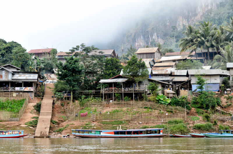
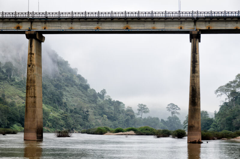
Nong Khiaw has natural beauty in spades. The town of Nong Khiaw sits in Ngoi (Ngoy) District — a name sometimes applied to the town itself, though Muang Ngoi (Neua) is the distinct village upriver. Nong Khiaw is a tiny place — no more than a few streets and a bridge. But that, in Lao terms, makes it more of a town than a village. The streets are on either side of the Nam Ou (Ou River). As morning mists rise from the steep riverbanks, they reveal steep limestone cliffs, or karsts, that frame the surrounding forest in a most picturesque way. The main part of town is at the base of a mountain that towers another 4,400 feet above it.1
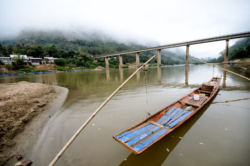
And the bridge is no rickety walkway made of bamboo like you see in some other river crossings in Southeast Asia. By far the most prominent artificial structure in the area, it’s and clearly took some engineering expertise to erect. It towers high over the river, safely above the swollen high water mark of the river during the rainy season.
Nong Khiaw is a step up in amenities from many of the nearby local villages — there’s electricity and running water — but not by much. It hasn’t yet been corrupted by the commercialism of higher-trafficked places. And being able to get to and from by boat — there are no major highways in this part of Laos and before 2021 there were no trains anywhere in the country — makes Nong Khiaw a nearly idyllic stopover.
We didn’t stay long — we had another day of driving to do — but it made for a very pleasant place to take a break. One day, I’ll be back to explore some more. But next time, I’ll come by riverboat.
Photos of Nong Khiaw
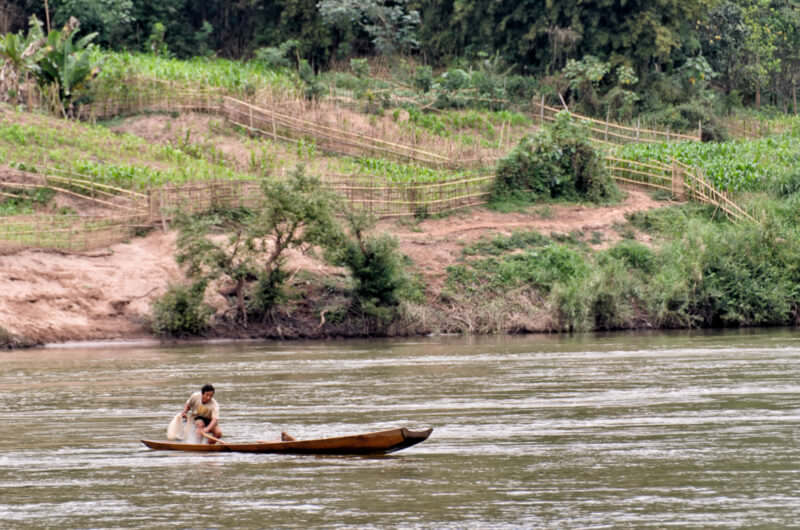
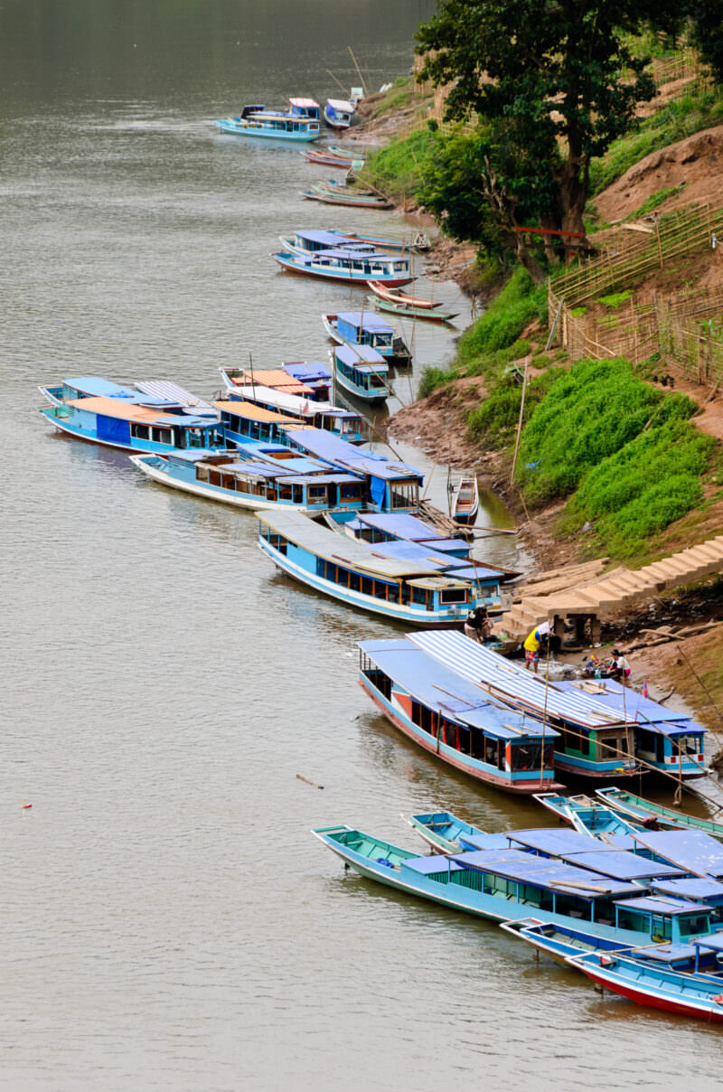
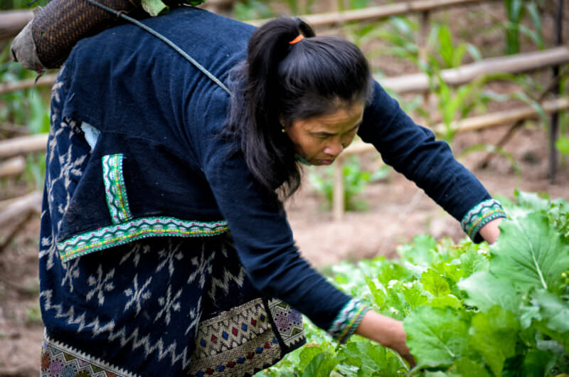
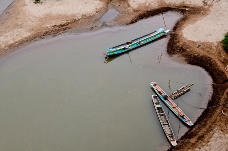
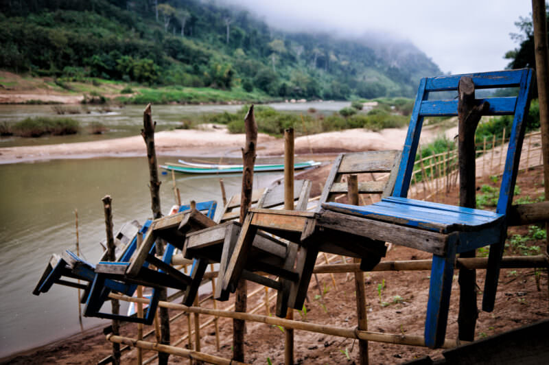
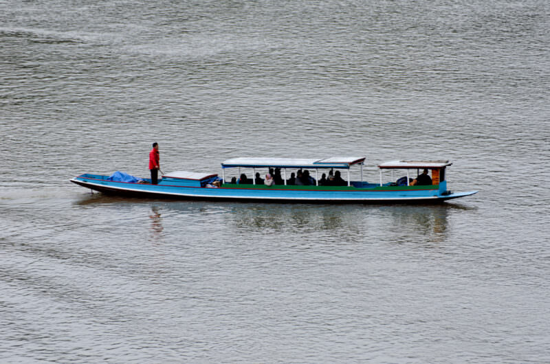
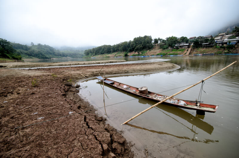
NONG KHIAW, Laos — A young Buddhist novice in saffron robes walks across the town’s concrete bridge over the Nam Ou, which links Nong Khiaw’s two banks and frames open views of the karst-lined river. In the Lao Theravada tradition, temporary ordination as a novice (samanera) is a standard rite of passage for boys, earning spiritual merit for their families and often providing access to formal education in rural provinces like Luang Prabang. The bridge is itself a landmark of the town, which spans both banks near the confluence of the Nam Ou and the Nam Houn amid some of northern Laos’s most dramatic limestone scenery. Photo by David Coleman / Have Camera Will TravelLicense this image at:DirectlyAlamyNONG KHIAW, Laos — Wooden stilt houses and longtail boats line the banks of the Nam Ou River beneath a towering limestone karst. The elevated architecture protects the settlement from dramatic water-level fluctuations during the annual monsoon season. These narrow boats provide essential transport along the waterway, a historic route that connects Luang Prabang to the Chinese border and one that has been navigated by river communities for generations. Photo by David Coleman / Have Camera Will TravelLicense this image at:DirectlyAlamyNONG KHIAW, Laos — A fisherman works a hand net from a wooden canoe on the Nam Ou River, backed by bamboo-fenced hillside gardens. The Nam Ou is a recognized biodiversity corridor: institutional surveys record around 139 fish species in its basin, of which at least 35 are endemic and five may be unique to the river. The cultivated riverbanks behind him make use of nutrient-rich silt deposited during the annual monsoon floods, combining seasonal agriculture with traditional subsistence fishing in a pattern that sustains communities throughout Luang Prabang Province. Photo by David Coleman / Have Camera Will TravelLicense this image at:DirectlyAlamyNONG KHIAW, Laos — Traditional wooden boats with blue canopies are moored along the banks of the Nam Ou at Nong Khiaw. The shallow-draft design of these longboats is adapted to navigate seasonal shallows and rocky rapids along one of the Mekong’s principal tributaries. For centuries this river corridor served as the primary artery connecting mountainous northern Laos to the Mekong, a historic route now increasingly fragmented by a cascade of hydroelectric dams constructed along the Nam Ou. Photo by David Coleman / Have Camera Will TravelLicense this image at:DirectlyAlamyNONG KHIAW, Laos — Wearing a traditional patterned sinh and embroidered jacket, a woman harvests leafy greens into a woven bamboo basket. Farmers along the Nam Ou River cultivate these temporary riverbank plots exclusively during the dry season, capitalizing on nutrient-rich silt deposited when monsoon floodwaters recede. The practice is woven into the rhythm of life along a river basin that supports more than 400,000 people, including Khmu, Lue, Hmong and ethnic Lao communities across northern Laos. Photo by David Coleman / Have Camera Will TravelLicense this image at:DirectlyAlamyNONG KHIAW, Laos — Traditional wooden canoes rest in a shallow sandy inlet along the Nam Ou, their long, narrow profiles adapted to the river’s shifting sediment and seasonal low waters. The Nam Ou is one of the principal Mekong tributaries, navigable as far north as Hatsa near Phongsaly town, and boats like these connect remote northern villages that remain beyond practical road access. The river supports around 139 fish species — at least 35 endemic to its basin — making these canoes instruments of both transport and subsistence fishing for communities throughout Luang Prabang Province. Photo by David Coleman / Have Camera Will TravelLicense this image at:DirectlyAlamyNONG KHIAW, Laos — Wooden chairs hang from a bamboo fence protecting a small vegetable plot along the banks of the Nam Ou River. During the dry season, receding waters expose nutrient-rich silt, allowing residents to cultivate these temporary riverside gardens until the summer monsoons swell the river and submerge the banks once again. These makeshift barriers defend the short-term crops from foraging livestock — a practical detail of dry-season agriculture along a river basin that sustains more than 400,000 people across northern Laos. Photo by David Coleman / Have Camera Will TravelLicense this image at:DirectlyAlamyNONG KHIAW, Laos — Tall concrete piers support a highway bridge spanning the Nam Ou River against a backdrop of misty limestone peaks. The karst here is Carboniferous – Permian in age; the surrounding mountains rise to roughly 5,580 feet (1,700 m), while upstream gorge walls are reported up to about 1,970 feet (600 m) high. The bridge links the two halves of Nong Khiaw — the west-bank town and the east-bank settlement of Ban Sop Houn — and offers open views up and down the river’s dramatic, cliff-lined corridor. Photo by David Coleman / Have Camera Will TravelLicense this image at:DirectlyAlamyNONG KHIAW, Laos — A traditional wooden longtail boat is moored along the Nam Ou River beneath the town’s concrete bridge, which links the west bank of Nong Khiaw with the east-bank settlement of Ban Sop Houn. The shallow draft of these narrow canoes allows them to navigate the rocky, mountainous stretches of this major Mekong tributary, navigable as far north as Hatsa near Phongsaly. They remain an essential transport link for remote communities throughout Luang Prabang and Phongsaly provinces where road access is limited. Photo by David Coleman / Have Camera Will TravelLicense this image at:DirectlyAlamyNONG KHIAW, Laos — A covered passenger boat navigates the Nam Ou at Nong Khiaw, its long shallow-draft hull designed to negotiate seasonal shallows and rocky stretches along this major Mekong tributary. The Nam Ou drains a basin of more than 400,000 people across a multi-ethnic mosaic of Khmu, Akha, Hmong, Lue, and lowland Lao communities, and river craft like this one remain the practical lifeline connecting isolated villages upriver to towns downstream. The river joins the Mekong at Ban Pak Ou, about 15 miles (24 km) above Luang Prabang. Photo by David Coleman / Have Camera Will TravelLicense this image at:DirectlyAlamyNONG KHIAW, Laos — A traditional wooden longtail boat is moored against a cracked mudbank along the Nam Ou River. The deep desiccation cracks in the exposed sediment highlight the waterway’s dramatic seasonal fluctuations — the same annual cycle that deposits nutrient-rich silt on the banks, enabling communities to cultivate temporary dry-season gardens before the monsoon swells the river again. These specialized shallow-draft vessels are built precisely to maintain vital transport links to remote villages when water levels drop to their lowest. Photo by David Coleman / Have Camera Will TravelLicense this image at:DirectlyAlamy
What to know before you go
Nong Khiaw is located about 3 hours north of Luang Prabang by bus. The journey is a bit bumpy, but the scenery along the way is well worth it. You’ll pass through small villages, rice paddies, and lush jungle. If you’re feeling adventurous, you can also take a boat from Luang Prabang to Nong Khiaw along the Nam Ou River.
There aren’t many places to exchange currency here or to get a cash advance on your credit card, so the best bet is to arrive with cash on hand. Some of the hotels provide internet, but not many and it’s often patchy.
One of the main attractions in Nong Khiaw is the stunning karst landscape. You can hike up to the top of Phadeng Peak for a panoramic view of the town and surrounding scenery. There are also several caves in the area that are worth exploring, including the Tham Pha Thok Cave and the Pha Kuang Cave.
If you’re looking for a more relaxing activity, you can take a boat trip along the Nam Ou River. The river is surrounded by towering cliffs and lush jungle, and you may even spot some wildlife along the way.
For a taste of local life, head to the morning market in the town center. Here you’ll find a variety of fresh produce, meats, and other goods.
There are a variety of accommodations in Nong Khiaw to fit any budget. For backpackers, there are several guesthouses and hostels in town. If you’re looking for something a bit more upscale, there are also several boutique hotels and resorts in the area.
The best time to visit Nong Khiaw is between November and February, when the weather is cool and dry. March to May can be quite hot, while June to October is the rainy season. However, even during the rainy season, Nong Khiaw is still worth a visit as the landscape is lush and green.
Notes & References:
Nong Khiaw sits at a valley floor of roughly 360 m (1,180 feet) above sea level; the surrounding limestone mountains rise to about 1,700 m (5,580 feet) above sea level. [↩︎]
Enjoyed this article? Personalize your search results.
I'm a freelance travel photographer based in Washington DC. Seven continents, up mountains, underwater, and a bunch of places in between. My images have appeared in numerous publications, and you can check out some of my gear reviews and tips here. More »