SAM NEUA, Laos — While the standing stones of Hintang in northeastern Laos don’t convey the kind of majesty of Stonehenge or Easter Island, their mysteries remain just as deep.
No one is quite sure who put them here or why. The standing stones of Hintang (or menhirs, if you want to be technical) aren’t nearly as grand as their cousins like Stonehenge or Easter Island. And they’re even overshadowed by the nearby jars that give the plain its name.
They are roughly contemporaneous with the jars, both broadly attributed to the Southeast Asian Iron Age. When this forgotten civilization lived — although it’s generally believed to have been thousands of years ago — or even who they were, isn’t clear. Like the jars, the standing stones are believed to have been involved somehow with ceremonial funerals. Beyond that, not much is known.
That they’ve attracted relatively little scholarly interest has little to do with their archeological significance and everything to do with their remoteness — at least for western archeologists — and the very real dangers of studying them.
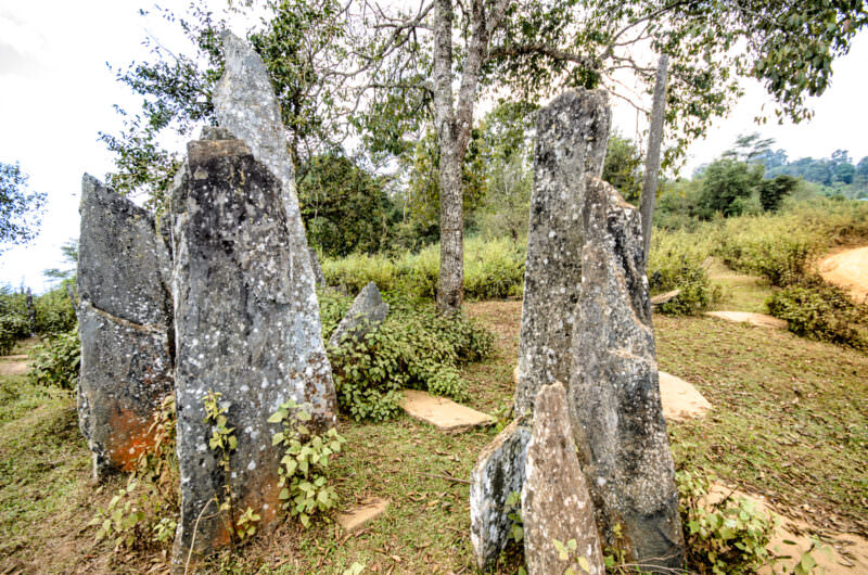
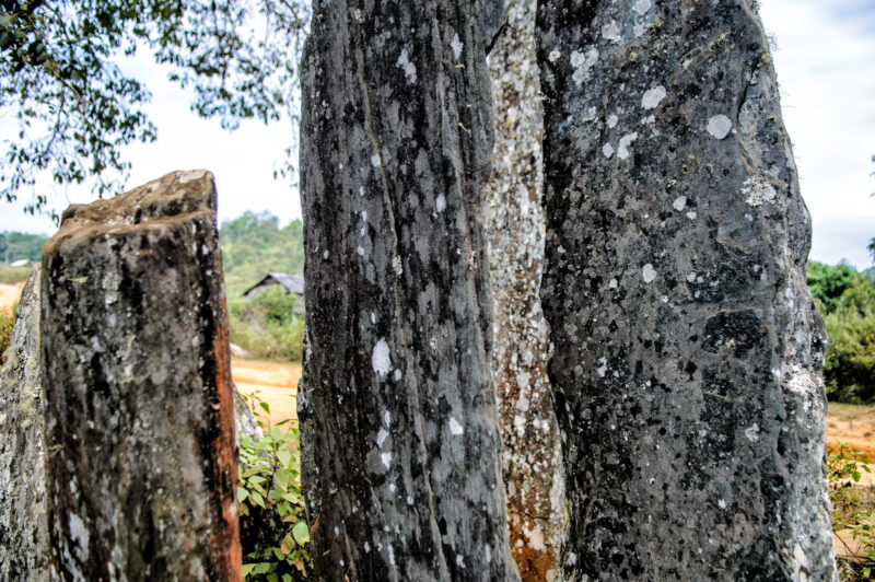
SAM NEUA, Laos — Weathered menhirs rise from the undergrowth at the Hintang archaeological site in Houaphanh Province. The slender pillars and flat stone disks scattered on the ground mark ancient burial sites — the disks serving as cover stones for rock-cut burial chambers sealed beneath. French archaeologist Madeleine Colani first examined these megaliths in 1931 and published her findings in her landmark 1935 monograph, *Mégalithes du Haut-Laos*, which treated Hintang alongside the Plain of Jars some 110 miles (177 km) to the southwest. Carved almost entirely from locally abundant mica schist, the undecorated stones range from about 16 inches (40 cm) to 11 feet (3.4 m) in exposed height and are broadly attributed to the Southeast Asian Iron Age. Photo by David Coleman / Have Camera Will TravelLicense this image at:DirectlyAlamy
The first archaeological work on them was done by French archaeologist Madeleine Colani, who surveyed the sites in 1931–1933 and published her findings in her landmark 1935 monograph, Mégalithes du Haut-Laos. While her work remains foundational, subsequent research has been conducted by Thongsa Sayavongkhamdy, Anna Källén, and Lia Genovese, among others.
But then the region became enveloped in civil war, with the French eventually abandoning Indochina. Then came what’s known here as The American War. While the focus of the fighting was across the border in Vietnam, American bombs rained down on the Plain of Jars. Over a period of 9 years, from 1964 to 1973, American bombers dropped something like 2 million tons of explosive ordnance on Laos in the course of about 580,000 bombing sorties. That’s an average of one bombing mission every eight minutes, all day and all night, for nine years. Most of it was over the Plain of Jars.
That any of the archeological sites survived at all is something of a miracle. Like entire villages that were wiped out by the bombing, some of the sites documented by Colani don’t seem to exist now. And when you see the deep craters that pockmark Laos and parts of southwest Vietnam, it’s easy to understand why.
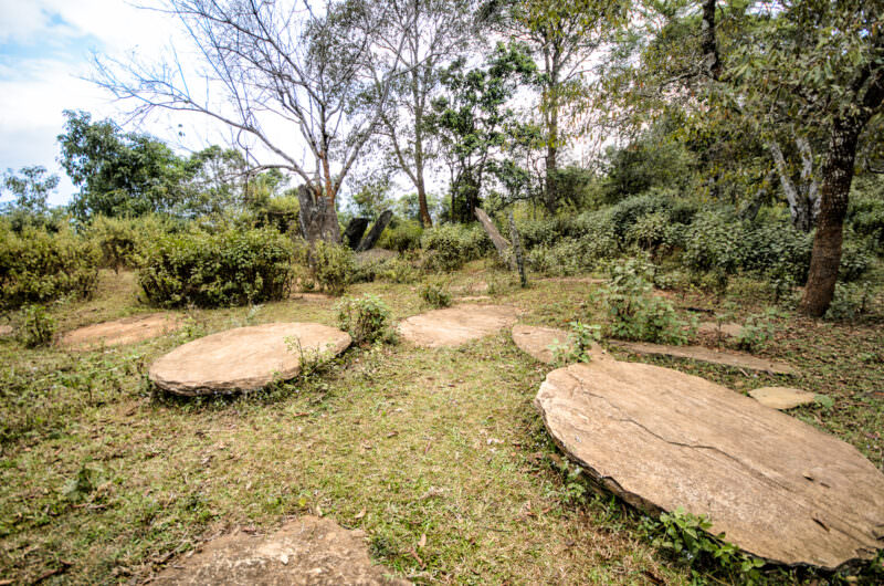
SAM NEUA, Laos — Flat, circular stone covers lie scattered across a wooded clearing, with jagged standing stones rising in the background at the Hintang archaeological site in Houaphanh Province. First systematically studied by French archaeologist Madeleine Colani beginning in 1931, these disks are cover stones that cap rock-cut burial chambers sunk into the bedrock — some slabs measuring more than 6.5 feet (2 m) across. Excavation of the chambers has yielded bronze ornaments, pottery, glass beads, and fragments of Chinese ceramic vessels, pointing to participation in regional exchange networks during the Southeast Asian Iron Age. This funerary architecture — vertical menhir above, concealed rock-cut tomb below — is what most clearly distinguishes the Hintang tradition from the hollowed stone jars of the nearby Plain of Jars. Photo by David Coleman / Have Camera Will TravelLicense this image at:DirectlyAlamy
But the bombing campaign is a horrible gift that keeps on giving. If all of the bombs that were dropped had exploded on impact, the destruction would have been immense, but it would have been in the past. But up to 30 percent of the bombs dropped did not explode, turning bombing targets into minefields. And that has created a deadly legacy for Laos of horrifying proportions. Even today, a person is killed nearly every day in Laos from unexploded ordnance. Nearly half of those killed are children.
In a more narrow sense, the unexploded ordinance (or UXO) problem has also kept archeologists away. Going poking around with shovels in the Lao wilderness isn’t the smartest idea with so much UXO lying around, hidden by nearly half a century of undergrowth and soil. As a result, little work has been done on the archaeological sites of northern and eastern Laos since the 1930s.
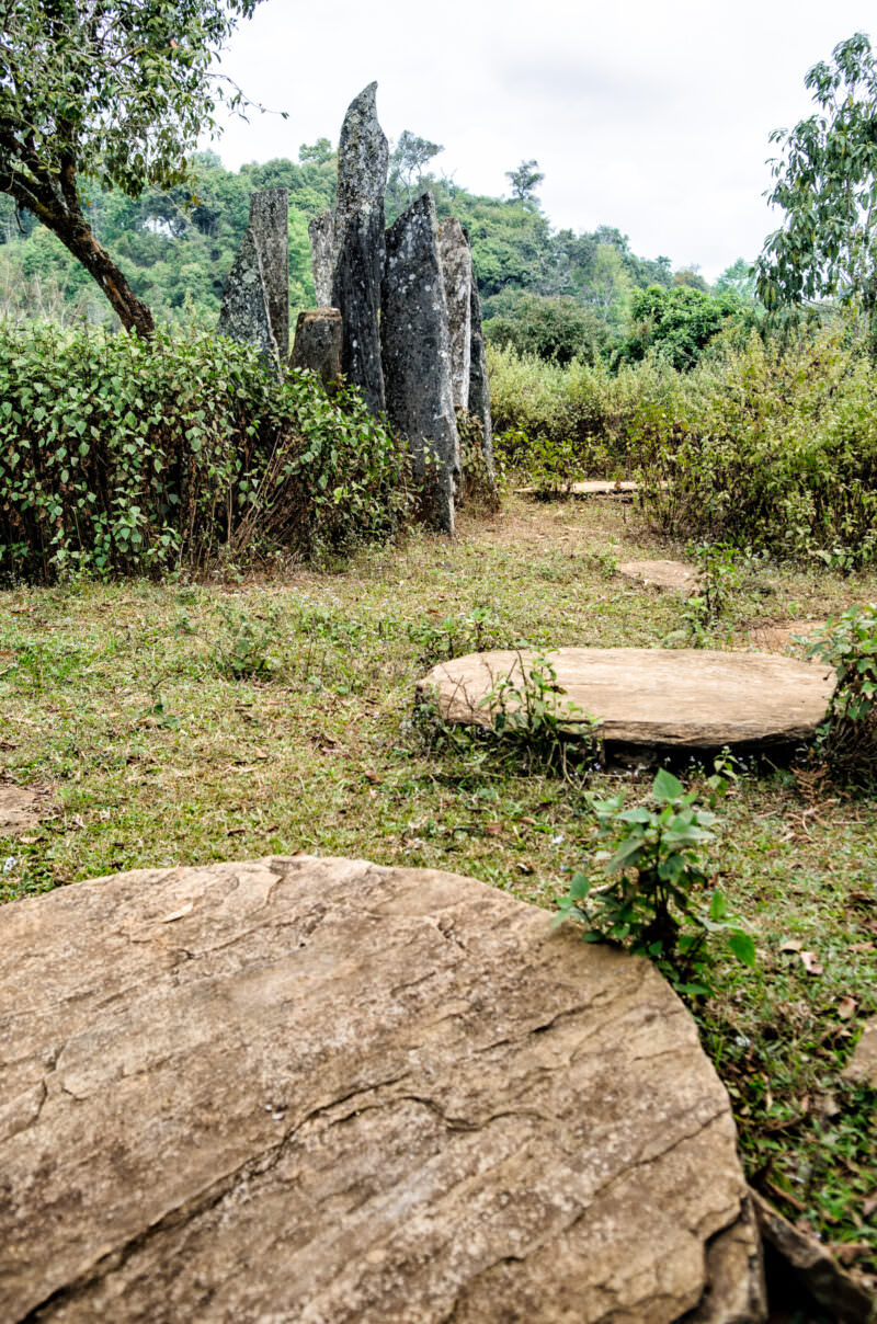
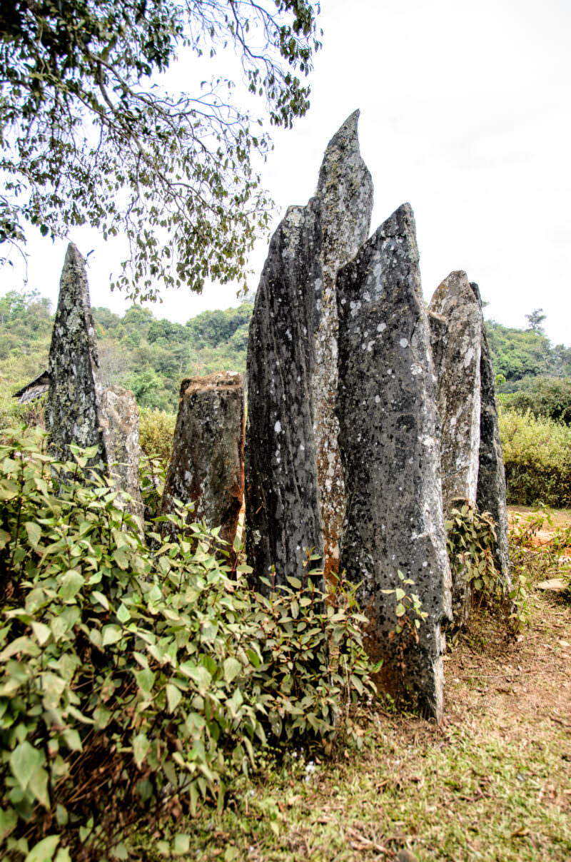
The standing stones at Hintang are spread across at least three sites. They feature jagged, flat stones standing vertically, ranging from about 16 inches (40 cm) to 11 feet (3.4 m) in exposed height. At ground level, deep holes are covered with flat, round covers, some of which have been removed.
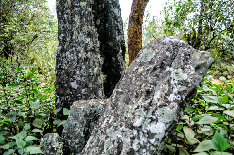
The sites are now quite overgrown, and any remains or artifacts that were presumably in the holes have long since disappeared, perhaps from looting. (Colani did find some artifacts in the chambers and jars nearby). Some of the standing stones have been knocked over or have fallen over. If there were once any markings on the stones, the elements have worn them away.
Have Camera Will Travel // Newsletter
Practical field notes, hands-on gear tests.
While the standing stones of Hintang don’t inherently convey the kind of majesty of Stonehenge or Easter Island, their mysteries remain just as deep.
SAM NEUA, Laos — Lichen-covered menhirs rise from a wooded clearing at the Hintang archaeological site in Houaphanh Province. French archaeologist Madeleine Colani first examined these megaliths in 1931 and published her findings in the 1935 monograph *Mégalithes du Haut-Laos*, which documented at least eight distinct menhir fields containing upright pillars and the flat stone disks visible on the ground — the latter serving as covers for rock-cut burial chambers beneath. Her excavations recovered bronze ornaments, pottery, glass beads, and human bone, confirming the site’s mortuary function, though comparatively few human remains were found and the precise nature of the burial ritual remains an open question. More than 1,500 menhirs have since been recorded across the broader landscape, and in 2026 the Lao government formally designated the site as national heritage. Photo by David Coleman / Have Camera Will TravelLicense this image at:DirectlyAlamySAM NEUA, Laos — Heavy lichen growth obscures the rough, undecorated surfaces of the Hintang menhirs in Houaphanh Province. French archaeologist Madeleine Colani first systematically documented these standing stones beginning in 1931, recovering bronze ornaments, pottery, glass beads, and fragments of human bone from the rock-cut burial chambers sealed by the flat stone disks interspersed among the pillars. While their exact origins remain unresolved, the menhirs are broadly attributed to the Southeast Asian Iron Age, with estimates ranging from roughly 1,000 to 3,000 years before present. Roughly a third of the structures continue to deteriorate from natural erosion, past wartime damage, and unexploded ordnance contamination left by the Second Indochina War. Photo by David Coleman / Have Camera Will TravelLicense this image at:DirectlyAlamy
SAM NEUA, Laos — Flat stone disks lie before a cluster of jagged menhirs at the Hintang archaeological site in Houaphanh Province. French archaeologist Madeleine Colani first documented these structures beginning in 1931, theorizing the circular stones capped subterranean burial shafts cut into the bedrock — an interpretation later confirmed by excavation of grave goods including bronze ornaments, pottery, glass beads, and human bone. Some of the covering slabs measure more than 6.5 feet (2 m) across, and the pairing of vertical marker-stone above with concealed rock-cut tomb below is the defining architectural signature of the Hintang tradition. The site’s creators remain unidentified, their work broadly attributed to the Southeast Asian Iron Age. Photo by David Coleman / Have Camera Will TravelLicense this image at:DirectlyAlamy
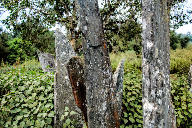
SAM NEUA, Laos — Lichen covers the rough surfaces of the ancient Hintang menhirs standing upright in Houaphanh Province. First examined in 1931 by French archaeologist Madeleine Colani of the École française d’Extrême-Orient, the stones were fully surveyed and published in her 1935 monograph *Mégalithes du Haut-Laos* — the foundational reference for both this site and the Plain of Jars. The tallest of the exposed menhirs reaches about 11 feet (3.4 m), and their undecorated, coarsely shaped sides contrast with the more carefully worked stone jars to the southwest. In March 2026 the Lao government formally designated the Hintang stones as national heritage, citing an intention to nominate them for UNESCO World Heritage status. Photo by David Coleman / Have Camera Will TravelLicense this image at:DirectlyAlamySAM NEUA, Laos — Lichen-mottled stone pillars rise from the undergrowth at the Hintang archaeological site in Houaphanh Province. French archaeologist Madeleine Colani first documented these menhirs beginning in 1931, her survey work revealing that the stones are carved almost entirely from mica schist, a locally abundant rock that splits naturally into the thin blade-like slabs seen here. Though their exact origins remain unknown, the upright stones are presumed to indicate burial sites — a function confirmed by excavated grave goods including bronze ornaments, pottery, and glass beads found in rock-cut chambers beneath the associated flat stone disks. The site was placed on the World Monuments Fund Watch list of endangered sites after road-building in the early 2000s directly damaged several menhir fields. Photo by David Coleman / Have Camera Will TravelLicense this image at:DirectlyAlamy
SAM NEUA, Laos — Lichen-mottled menhirs rise from the brush at the Hintang archaeological site in Houaphanh Province. French archaeologist Madeleine Colani first examined these megaliths in 1931 and surveyed at least eight distinct menhir fields across the region by 1933, finding that the stones were carved almost entirely from mica schist — a locally abundant rock that fractures naturally into the thin, upright slabs visible here. Though their exact creators remain unknown, the standing stones are presumed to mark ancient burial sites, their funerary purpose confirmed by grave goods — bronze ornaments, pottery, glass beads, and fragments of human bone — recovered from rock-cut chambers beneath the associated stone disks. The site has been designated Lao national heritage and is a candidate for future UNESCO World Heritage nomination. Photo by David Coleman / Have Camera Will TravelLicense this image at:DirectlyAlamy
What to know before you go
This is not a major tourist site and is not signed. You really need a local guide to show you where it is.
There are no signs or a visitor center or any other facilities.
Enjoyed this article? Personalize your search results.
I'm a freelance travel photographer based in Washington DC. Seven continents, up mountains, underwater, and a bunch of places in between. My images have appeared in numerous publications, and you can check out some of my gear reviews and tips here. More »