NORTH STRADBROKE ISLAND, Australia — Known to the locals as “Straddie,” North Stradbroke Island near Brisbane separates southern Moreton Bay from the Pacific Ocean. With miles of spectacular ocean beaches and an abundance of local marine life such as whales, sharks, turtles, and dolphins, it’s a popular summer holiday destination and yet still manages to feel remote.
Unless you live in Southeast Queensland, there’s a good chance you’ve never heard of North Stradbroke Island. Although it barely rates a mention in most travel guidebooks, North Stradbroke Island — “Straddie” to the locals — has an awful lot going for it.
In a part of the world blessed with some of the world’s most stunning beaches, Queensland’s are among the best. And this is an island of sand — the second-largest sand island in the world, as it happens, only beaten by K’gari (Fraser Island), which is a bit to the north and harder to get to.
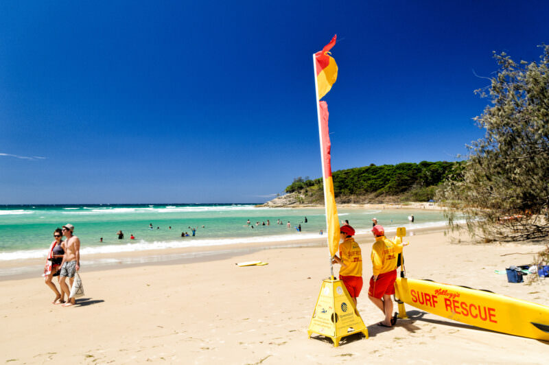
NORTH STRADBROKE ISLAND, Australia — Surf lifesavers monitor swimmers between the red and yellow flags at Cylinder Beach. Surf Life Saving Australia uses these standardized colors to delineate actively supervised bathing zones, a vital safeguard on a coastline where shifting sandbars and ocean rips can develop quickly. The beach sits on Minjerribah, the world’s second-largest sand island and the traditional Country of the Quandamooka people, in Moreton Bay about 19 miles (30 kilometers) south-east of Brisbane. Photo by David Coleman / Have Camera Will TravelLicense this image at:DirectlyAlamy
North Stradbroke Island, near Brisbane, separates southern Moreton Bay from the Pacific Ocean. At one point, it was joined to what is now known as South Stradbroke Island, but storms on 8 – 9 May 1898 blew a channel between the two sand islands.
While many still know it as North Stradbroke Island, the land is officially returning to its traditional name, Minjerribah. This change recognizes the Quandamooka people as the traditional owners of the island, a connection that spans at least 30,000 to 49,000 years according to recent dating. In 2011, the Federal Court of Australia granted native title to the Quandamooka people, leading to the dual-naming and gradual shift toward using Minjerribah in official and local contexts.
Who was Stradbroke? The European name dates back to 1827, when surveyor John Oxley and others charted the area; Governor Darling later applied the name honoring the Earl of Stradbroke. The settlement of Dunwich takes its name from the Viscountcy of Dunwich, with the connection traced to naval surveyor Captain J.N. Rous and his 1827 work. Captain Rous also named the Rainbow Channel after his vessel.
So if you’re visiting today, you will notice “Minjerribah” appearing on more signage and maps — a nod to the island’s deep Indigenous history that predates the 19th-century English namesake.
The only way there is by boat — there’s no airport, and there’s no bridge. There is a regular car ferry from Cleveland and Redland Bay.
As you would hope for open ocean, marine wildlife thrives here. Dolphins play in the surf, whales come in nearby regularly each year, prompting an annual pilgrimage of whale watchers at Point Lookout, sea turtles come in near the rocky headlands to feed, and yes, there are sharks — quite a lot of sharks, actually. Great Whites cruise the coast, and herds of bull sharks venture into the passage between Stradbroke and Moreton islands to the calmer, western side of the island.
The Amity Island in Jaws was a fictional place, but the real Amity Point on Stradbroke Island has, unfortunately, been the site of some horrific recent shark attacks. But as much press coverage as those attacks generate, they’re rare, and common sense offers excellent protection.
Here’s a selection of the photos I have available as high-resolution digital images to license/buy and download. The links in the captions will take you directly to that image’s licensing and download page.
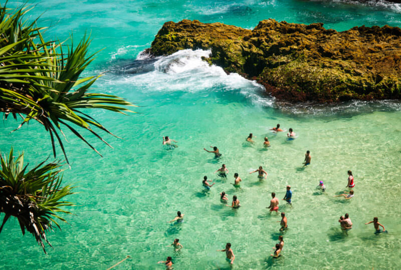
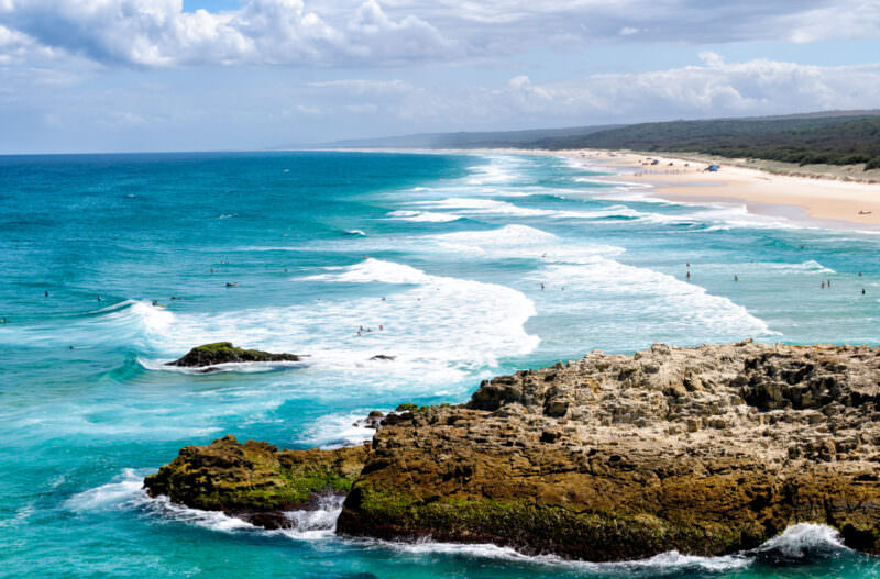
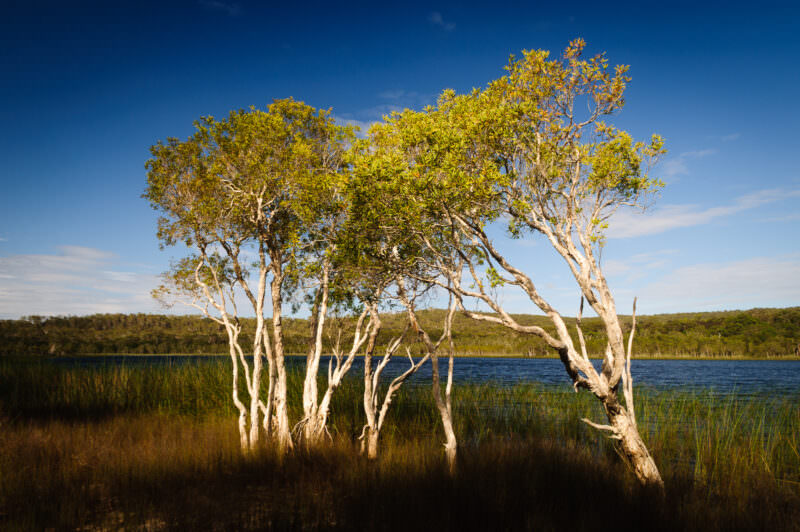
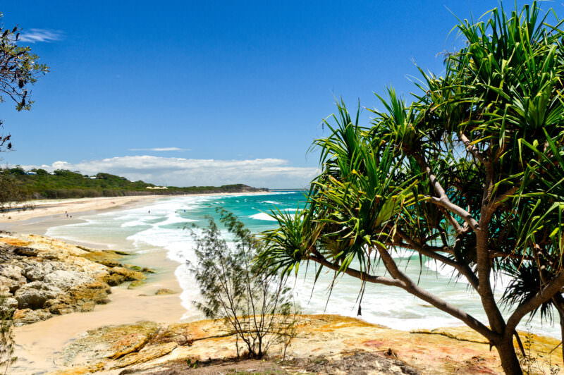
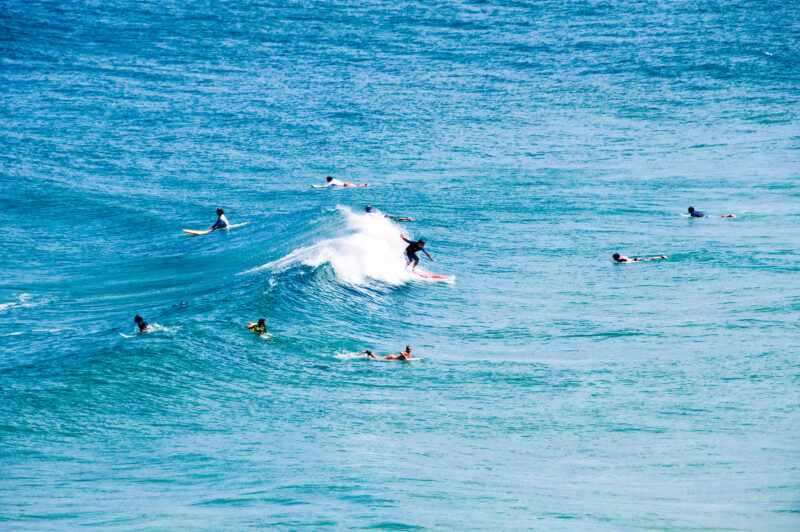
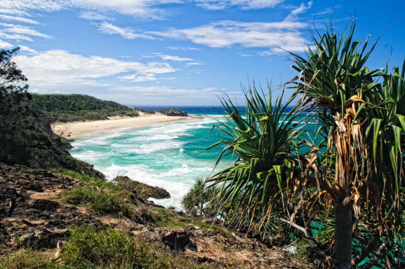
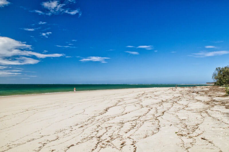
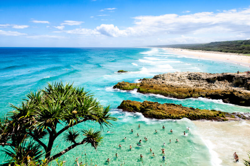
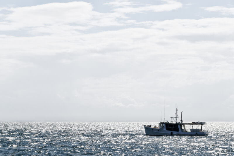
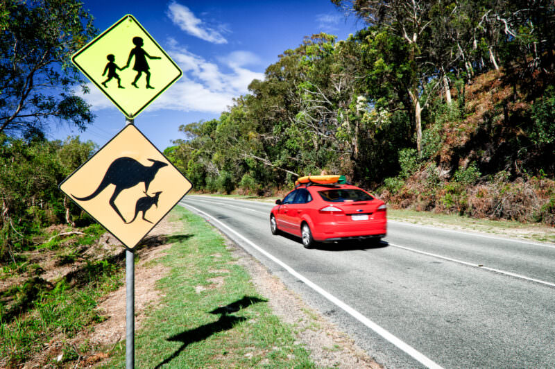
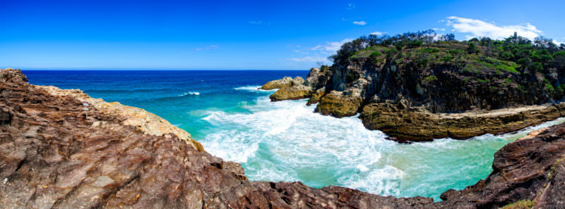
NORTH STRADBROKE ISLAND, Australia — Leaves of a coastal screw pine (Pandanus tectorius) frame swimmers wading in a rock alcove at Point Lookout on Minjerribah. Rhyolite outcrops form a natural breakwater against the Coral Sea. While the rest of the world’s second-largest sand island consists of accumulated dunes, this volcanic headland provides a rare geological anchor at Queensland’s easternmost point. Photo by David Coleman / Have Camera Will TravelLicense this image at:DirectlyAlamyNORTH STRADBROKE ISLAND, Australia — The rocky headland of Point Lookout overlooks the Pacific Ocean and a continuous stretch of sandy beach along the Queensland coast. Known traditionally as Minjerribah, the island covers roughly 106 square miles (275 sq km) and ranks as the world’s second-largest sand island behind K’gari (Fraser Island). The rocky outcrop in the foreground acts as a crucial geological anchor, stabilizing the massive dune systems that make up virtually the entire landmass. Photo by David Coleman / Have Camera Will TravelLicense this image at:DirectlyAlamyNORTH STRADBROKE ISLAND, Queensland, Australia — Paperbark trees line the reedy shoreline of Brown Lake, known to the Quandamooka people as Bummiera, a freshwater perched lake on Minjerribah. The Melaleuca foliage leaches tannins into the accumulated rainwater, creating the lake’s characteristic tea-brown hue. An underlying layer of indurated sand — locally called coffee rock — acts as a waterproof seal, preventing surface water from draining into the regional aquifer below. The lake and the island’s other freshwater systems lie within the Moreton Bay Ramsar site, listed in 1993, and are protected under the joint management of the Quandamooka Yoolooburrabee Aboriginal Corporation and Queensland Parks and Wildlife Service. Photo by David Coleman / Have Camera Will TravelLicense this image at:DirectlyAlamyNORTH STRADBROKE ISLAND, Australia — A native coastal screw pine frames the rocky foreground of Cylinder Beach along the northern coastline of Minjerribah, the traditional Country of the Quandamooka people. The Pandanus tectorius anchors the foredunes of the world’s second-largest sand island against erosion, its robust prop roots gripping the nutrient-poor, salt-sprayed substrate that would defeat most other species. Known as the Quandamooka people, the community descends from the Nunukul, Goenpul, and Ngugi clans, whose occupation of the island now extends — on the most recent dating — to roughly 30,000 to 49,000 years ago. Photo by David Coleman / Have Camera Will TravelLicense this image at:DirectlyAlamyNORTH STRADBROKE ISLAND, Australia — Surfers ride breaking waves in the Pacific Ocean off Point Lookout. The ocean swells here are shaped by the coastal geology of North Stradbroke Island, also known as Minjerribah, which ranks as the world’s second-largest sand island behind K’gari (Fraser Island) and covers roughly 106 square miles (275 sq km). The rocky headland generating these breaks forms the easternmost point of Queensland. Photo by David Coleman / Have Camera Will TravelLicense this image at:DirectlyAlamyNORTH STRADBROKE ISLAND, Queensland, Australia — Surf breaks along the shoreline viewed northward from Point Lookout, Queensland’s easternmost headland. In the foreground, Pandanus tectorius trees use specialized prop roots to anchor into the shifting substrate, stabilizing the coastal dunes of an island built almost entirely of accumulated sand. Known as Minjerribah — “Island in the Sun” — to the Quandamooka people, the island covers roughly 106 square miles (275 sq km) and is commonly cited as the world’s second-largest sand island after K’gari (Fraser Island). Photo by David Coleman / Have Camera Will TravelLicense this image at:DirectlyAlamyNORTH STRADBROKE ISLAND, Queensland, Australia — Lines of tidal debris trace the high-water mark across Amity Point beach as a lone figure walks near the shallows. Amity Point sits on the island’s north-western corner, facing the sheltered waters of Moreton Bay rather than the open Pacific, giving it a calmer character than the surf beaches at Point Lookout. The settlement takes its name from the vessel of the surveyor John Oxley, and the beach wrack deposited by the receding tide provides marine nutrients that support the coastal dune ecosystems of Minjerribah — the traditional home of the Quandamooka people, whose occupation of the island has been dated by recent luminescence studies to between roughly 30,000 and 49,000 years ago, among the oldest documented on Australia’s eastern seaboard. Photo by David Coleman / Have Camera Will TravelLicense this image at:DirectlyAlamyNORTH STRADBROKE ISLAND, Australia — Swimmers and surfers navigate the clear shallows around a rocky headland at Point Lookout. The foreground is framed by a coastal screw pine (Pandanus tectorius) bearing its segmented, pineapple-like fruit. This highly salt-tolerant species acts as a frontline defense for Indo-Pacific shorelines, utilizing a robust network of prop roots to anchor sand dunes against cyclonic winds and coastal erosion on the world’s second-largest sand island. Photo by David Coleman / Have Camera Will TravelLicense this image at:DirectlyAlamyNORTH STRADBROKE ISLAND, Queensland, Australia — A Moreton Bay Cruiser anchors in the backlit waters off Minjerribah, its broad beam and shallow draft suited to the shifting sandbanks of Moreton Bay. The bay separates the Australian mainland from North Stradbroke Island — at roughly 106 square miles (275.2 km²), the world’s second-largest sand island after K’gari (Fraser Island), its dune systems built over the Pleistocene by wind-driven sand carried north along the eastern Australian coast. These waters form part of the sea country of the Quandamooka people, whose native title rights over roughly 29,505 hectares of offshore waters were formally recognised by the Federal Court of Australia on 4 July 2011, in two consent determinations covering a combined area of about 54,408 hectares on and around the island. Photo by David Coleman / Have Camera Will TravelLicense this image at:DirectlyAlamyNORTH STRADBROKE ISLAND, Queensland, Australia — A red car passes a modified kangaroo warning sign depicting an adult and joey beneath a pedestrian crossing marker. The joey’s inclusion reflects the active Eastern Grey Kangaroo populations on Minjerribah, the traditional Quandamooka name for the island — roughly 106 square miles (275.2 km²) of sand dunes, coastal heath and bushland forming the world’s second-largest sand island after K’gari (Fraser Island). These paved corridors bisect the island’s dune systems, forcing native marsupials to navigate increasingly fragmented habitat as visitor numbers grow. Photo by David Coleman / Have Camera Will TravelLicense this image at:DirectlyNORTH STRADBROKE ISLAND, Queensland, Australia — Ocean waves crash against the rugged cliffs of the Point Lookout headland. The visible outcrops consist of volcanic rhyolite and trachyte rock, forming a rare geological anomaly. This hard volcanic anchor stands in stark contrast to the rest of Minjerribah (also known as North Stradbroke Island), which ranks as the world’s second-largest sand island. Photo by David Coleman / Have Camera Will TravelLicense this image at:DirectlyAlamy
What to know before you go
Stradbroke is an easy day trip from Queensland’s capital city, Brisbane.
There’s no airport or bridge. The only way there is by boat (or a very long swim.)
Your best option is to take a car across on the car ferry from Cleveland or Redland Bay. Without a car, it’s quite a bit harder to get around — the ferry drops you off on the bay side of the island in Dunwich, which, while pleasant enough, doesn’t have the long surf beaches of the ocean side. But whatever you do, don’t try to drive there, even if your GPS says you can. That stuff that looks like water is water. Really.
Australia
Enjoyed this article? Personalize your search results.
I'm a freelance travel photographer based in Washington DC. Seven continents, up mountains, underwater, and a bunch of places in between. My images have appeared in numerous publications, and you can check out some of my gear reviews and tips here. More »